

Dargazin-e Sofla Rural District (Persian: دهستان درگزین سفلی)[a] is in the Central District of Dargazin County, Hamadan province, Iran. Its capital is the village of Dargazin.[3]
At the National Census of 2006, its population (as a part of the former Qorveh-e Darjazin District of Razan County) was 13,617 in 3,321 households.[4] There were 13,486 inhabitants in 3,925 households at the following census of 2011.[5] At the most recent census of 2016, the population of the rural district was 13,067 in 4,062 households. The most populous of its 17 villages was Omman, with 2,305 people.[2]
After the census, the district was separated from the county in the establishment of Dargazin County, which was divided into two districts of two rural districts each, with the city of Qorveh-e Dargazin as its capital.[3]
Notes
- ^ Formerly Darjazin-e Sofla Rural District (دهستان درجزين سفلی)
References
- ^ OpenStreetMap contributors (19 October 2023). "Dargazin-e Sofla Rural District (Dargazin County)" (Map). OpenStreetMap. Retrieved 19 October 2023.
- ^ a b "Census of the Islamic Republic of Iran, 1395 (2016)". AMAR (in Persian). The Statistical Center of Iran. p. 13. Archived from the original (Excel) on 21 April 2021. Retrieved 19 December 2022.
- ^ a b Jahangiri, Ishaq (8 December 1397). "Letter of approval regarding country divisions in Razan County of Hamadan province". Laws and Regulations Portal of the Islamic Republic of Iran (in Persian). Ministry of Interior, Council of Ministers. Archived from the original on 31 July 2023. Retrieved 19 October 2023.
- ^ "Census of the Islamic Republic of Iran, 1385 (2006)". AMAR (in Persian). The Statistical Center of Iran. p. 13. Archived from the original (Excel) on 20 September 2011. Retrieved 25 September 2022.
- ^ "Census of the Islamic Republic of Iran, 1390 (2011)". Syracuse University (in Persian). The Statistical Center of Iran. p. 13. Archived from the original (Excel) on 17 January 2023. Retrieved 19 December 2022.
Hamadan Province, Iran | |||||||||||||||||||||
|---|---|---|---|---|---|---|---|---|---|---|---|---|---|---|---|---|---|---|---|---|---|
| Capital | 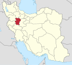 | ||||||||||||||||||||
| Counties and cities |
| ||||||||||||||||||||
| Sights |
| ||||||||||||||||||||
| populated places | |||||||||||||||||||||
This Hamadan province location article is a stub. You can help Wikipedia by expanding it. |