
| Beaver Brook Wildlife Area | |
|---|---|
IUCN category V (protected landscape/seascape)[1] | |
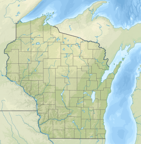 Location in Wisconsin  Location in United States | |
| Location | Washburn County, Wisconsin |
| Nearest city | Spooner, Wisconsin |
| Coordinates | 45°46′58″N 91°51′15″W / 45.78286°N 91.85408°W |
| Area | 1,968 acres (7.96 km2) |
| Established | 1951 |
| Governing body | Wisconsin Department of Natural Resources |
The Beaver Brook Wildlife Area is a 1,968-acre (7.96 km2) tract of protected land located in Washburn County, Wisconsin, managed by the Wisconsin Department of Natural Resources (WDNR).[2] The wildlife area is in place to protect trout stream habitats and provide recreation experiences through its many trails.
History
Beaver Brook Wildlife Area was gazetted with an initial land acquisition of 680 acres from the county government. Ten further purchases of land from private owenership have increased the acreage significantly, with the additional goal of expanding recreation area. The wildlife area is bound to the west by the Wild Rivers State Trail, a former railroad track that stretches 104 miles.[3] The trail runs up against remnants of houses and an old logging dam, removed in 1910.[4]
Cranberry bogs are prevalent in Washburn County, and the marsh and wetland land coverage in both the county and the wildlife area is ideal for cranberry cultivation. The cultivation of cranberries, specifically the establishment of cranberry reservoirs is harmful to trout populations,[5]: 23 and this led to the purchasing of 560 acres of private land in 2003 by the WDNR in conjuction with the Wisconsin Department of Transportation.[6] The purchased plot, (the largest of the Wildlife Area) included a developed 81.5-acre (0.330 km2) cranberry bog. This developed marsh was restored to cranberry beds and the flow of the eponymous stream was restored.[2]
Land cover
The main feature of the wildlife area is the upland deciduous habitat, making up over nearly one third of the total area. There are many notable examples of large aspen and northern hardwood trees in the deciduous habitat, with mainly old growth sections in the natural area enclave.
| Cover type | Acres | Percentage cover |
|---|---|---|
| Developed | 7 | <1% |
| Forested wetland | 200 | 10% |
| Open water | 47 | <1% |
| Open wetland/marsh | 274 | 14% |
| Upland conifer | 84 | 4% |
| Upland deciduous | 1,238 | 63% |
| Upland grass | 14 | <1% |
| Upland shrub | 8 | <1% |
| Shrub wetland | 96 | 5% |
| Total cover | 1,968 | 100% |
Beaver Brook State Natural Area
The Beaver Brook State Natural Area is a unit of the larger wildlife area that contains Beaver Brook, a high quality Class I trout stream.[8][9]
The stream corridor protects patches of old growth northern dry-mesic forests and a number of species of special concern.[7]: 24
References
- ^ Protected Area Profile for Beaver Brook Wildlife Area Archived January 11, 2024, at the Wayback Machine from the World Database on Protected Areas. Retrieved January 11, 2024.
- ^ a b "WDNR Beaver Brook WFA Website". Archived from the original on January 11, 2024. Retrieved January 11, 2024.
- ^ "WDNR Wild Rivers State Trail Website". Archived from the original on January 11, 2024. Retrieved January 11, 2024.
- ^ "Washburn County Beaver Brook Website". Archived from the original on January 11, 2024. Retrieved January 11, 2024.
- ^ "US Army Corps of Engineers St. Paul District Analysis of Commercial Cranberry Operations" (PDF). Archived (PDF) from the original on January 11, 2024. Retrieved January 11, 2024.
- ^ "Feasibility Assessment and Environmental Analysis of Beaver Brook Wildlife Area Expansion" (PDF). Archived (PDF) from the original on January 11, 2024. Retrieved January 11, 2024.
- ^ a b "WDNR Northwest Sands Regional Master Plan PDF". Retrieved May 12, 2023.
- ^ "WDNR Beaver Brook SNA Website". Archived from the original on January 11, 2024. Retrieved January 11, 2024.
- ^ "WDNR Beaver Brook SNA Map PDF". Archived from the original on January 11, 2024. Retrieved January 11, 2024.
External links
- WDNR Public Access Lands Map at the WDNR Public Access Lands Map Website. Retrieved February 27, 2023.