
Asaluyeh County
Persian: شهرستان عسلویه | |
|---|---|
County | |
 Location of Asaluyeh County in Bushehr province (bottom, pink) | |
 Location of Bushehr province in Iran | |
| Coordinates: 27°27′N 52°44′E / 27.450°N 52.733°E[1] | |
| Country | |
| Province | Bushehr |
| Capital | Asaluyeh |
| Districts | Central, Chah-e Mobarak |
| Population (2016) | |
| • Total | 73,958 |
| Time zone | UTC+3:30 (IRST) |
| Asaluyeh County can be found at GEOnet Names Server, at this link, by opening the Advanced Search box, entering "9206097" in the "Unique Feature Id" form, and clicking on "Search Database". | |
Asaluyeh County (Persian: شهرستان عسلویه) is in Bushehr province, Iran. Its capital is the city of Asaluyeh.[2]
After the 2011 census, Asaluyeh District was separated from Kangan County in the establishment of Asaluyeh County, which was divided into two districts of two rural districts each, with the city of Asaluyeh as its capital.[2]
At the 2016 National Census, the county's population was 73,958 in 16,496 households.[3]
Administrative divisions
The structure of Asaluyeh County's administrative divisions is shown in the following table. The latest census shows two districts, four rural districts, and two cities.[3]
After the census, the villages of Bid Khun[4] and Chah-e Mobarak[5] were elevated to city status.
| Administrative Divisions | 2016[3] | ||
|---|---|---|---|
| Central District | 56,255 | ||
| Akhand RD | 10,385 | ||
| Asaluyeh RD | 13,476 | ||
| Asaluyeh (city) | 13,557 | ||
| Bid Khun (city)1 | |||
| Nakhl Taqi (city) | 18,837 | ||
| Chah-e Mobarak District | 17,703 | ||
| Chah-e Mobarak RD | 12,078 | ||
| Nayband RD | 5,625 | ||
| Chah-e Mobarak (city)1 | |||
| Total | 73,958 | ||
| RD: Rural District 1Became a city after the 2016 census[4][5] | |||
References
- ^ OpenStreetMap contributors (29 March 2023). "Asaluyeh County" (Map). OpenStreetMap. Retrieved 29 March 2023.
- ^ a b Rahimi, Mohammad Reza (29 September 2013). "Approval letter regarding country divisions in Bushehr province". Islamic Parliament Research Center of the Islamic Republic of Iran (in Persian). Ministry of Interior. Archived from the original on 10 January 2013. Retrieved 29 March 2023.
- ^ a b c "Census of the Islamic Republic of Iran, 1395 (2016)". AMAR (in Persian). The Statistical Center of Iran. p. 18. Archived from the original (Excel) on 3 August 2017. Retrieved 19 December 2022.
- ^ a b "The government board's agreement with the development of Baharestan and Bid Khun villages". Fars News (in Persian). 18 July 1397. Archived from the original on 6 November 2023. Retrieved 6 November 2023.
- ^ a b "In Asaluyeh County, Chah-e Mobarak Municipality was opened". Mehr News (in Persian). 21 March 2016. Archived from the original on 6 November 2023. Retrieved 6 November 2023.
Bushehr Province, Iran | |||||||||||||||||||||
|---|---|---|---|---|---|---|---|---|---|---|---|---|---|---|---|---|---|---|---|---|---|
| Capital | 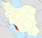 | ||||||||||||||||||||
| Counties and cities |
| ||||||||||||||||||||
| Landmarks |
| ||||||||||||||||||||
| populated places | |||||||||||||||||||||
| Capital | |||||||||||||||||||||
|---|---|---|---|---|---|---|---|---|---|---|---|---|---|---|---|---|---|---|---|---|---|
| Districts |
| ||||||||||||||||||||
This Bushehr province location article is a stub. You can help Wikipedia by expanding it. |