
Deyr County
Persian: شهرستان دَیِّر | |
|---|---|
County | |
 Deyr | |
 Location of Deyr County in Bushehr province (bottom, green) | |
 Location of Bushehr province in Iran | |
| Coordinates: 28°01′N 51°42′E / 28.017°N 51.700°E[1] | |
| Country | |
| Province | Bushehr |
| Capital | Bandar-e Deyr |
| Districts | Central, Abdan, Bord Khun |
| Area | |
| • Total | 2,261 km2 (873 sq mi) |
| Population (2016) | |
| • Total | 60,612 |
| • Density | 27/km2 (69/sq mi) |
| Time zone | UTC+3:30 (IRST) |
| Deyr County can be found at GEOnet Names Server, at this link, by opening the Advanced Search box, entering "9206095" in the "Unique Feature Id" form, and clicking on "Search Database". | |
Deyr County (Persian: شهرستان دَیِّر)[a] is in Bushehr province, Iran. Its capital is the city of Bandar-e Deyr.[2]
At the 2006 census, the county's population was 48,488 in 10,036 households.[3] The following census in 2011 counted 52,523 people in 12,779 households,[4] and the village of Bardestan had become a city.[5] At the 2016 census, the county's population was 60,612 in 16,403 households,[6] by which time the village of Dowrahak had been elevated to the status of a city.[7] In addition, Abdan Rural District and the city of Abdan had been separated from the district in the establishment of Abdan District. Owli Rural District was established in the Central District as well.[8]
Etymology
According to some historians Daiyir was named after a Jewish synagogue located in the heart of Daiyir.[9] The word Daiyir probably is derived from the Hebraic word (דייר) which means resident.[citation needed]
History
Lorimer in his famous work, Gazetteer of the Persian Gulf, wrote that Daiyir consist partly of stone houses and partly of huts and is protected by a fort with towers, the population is about 5500 souls, including some Al-Nasur, some Bahrainis, and some Jews, but the bulk of the people claim to have come originally from Kufah.[10]
Overview
Deyr county is one of the nine counties in Bushehr Province, Iran. It has an area of 4000 km2.
Some historians believe, that Deyr county was exclusively inhabited by Jews, but by years the Muslims settled in the county, and a large proportion of Deyr county's Jews converted to Islam during the Safavid dynasty.
The population nowadays is Muslim; the Jewish inhabitants left the county in 1979. Persians and Arabs are the major races in Deyr, the citizens of Deyr speaks various forms of Persian languages including Persian and the local Deyr dialect. The capital of the county is Bandar Deyr, which is considered as a prominent harbor in the Persian Gulf.
Deyr County is bounded by the Persian Gulf to the west and south, Tangestan County & Dashti county to the north, Kangan County and Jam County to the east.
Deyr County has a climate that is mostly arid or semiarid. The highest point in the county is Mount Drang at 1,223 m. Natural gas is extracted in the county. Wheat, tomatoes, corn, and other grains are grown. There is a local fishing industry.
Deyr county includes three small towns & four villages, and several small islands such as Khan island (area, 800 hectares) and Nakhilu island (area, 75 hectares).
Climate and water: Deyr county has a very hot & humid summer, the temperature could reach 47 °C sometimes. Mond River is the only river in Deyr county, and there is plenty of spring water.
Mammals and Birds: Deyr county has various mammal and bird species, such as camels, deer, foxes, rabbits, owls, hawks and flamingos, and caracals, striped hyenas, wolves and jackals rarely can be seen. Mond natural reservation has an area of 464 km2, conserving local animals and plants.
Administrative divisions
The population history and structural changes of Deyr County's administrative divisions over three consecutive censuses are shown in the following table. The latest census shows three districts, six rural districts, and five cities.[6]
| Administrative Divisions | 2006[3] | 2011[4] | 2016[6] |
|---|---|---|---|
| Central District | 39,119 | 42,765 | 40,970 |
| Abdan RD | 1,668 | 1,698 | |
| Howmeh RD | 12,939 | 8,621 | 2,963 |
| Owli RD | 1,960 | ||
| Abdan (city) | 6,058 | 6,211 | |
| Bandar-e Deyr (city) | 18,454 | 20,157 | 24,083 |
| Bardestan (city) | 6,078 | 7,112 | |
| Dowrahak (city) | 4,852 | ||
| Abdan District | 8,529 | ||
| Abdan RD | 954 | ||
| Sar Mastan RD | 748 | ||
| Abdan (city) | 6,827 | ||
| Bord Khun District | 9,369 | 9,758 | 11,113 |
| Abkosh RD | 3,954 | 4,222 | 4,352 |
| Bord Khun RD | 1,115 | 1,160 | 1,428 |
| Bord Khun (city) | 4,300 | 4,376 | 5,333 |
| Total | 48,488 | 52,523 | 60,612 |
| RD = Rural District | |||
Notes
References
- ^ OpenStreetMap contributors (31 March 2023). "Deyr County" (Map). OpenStreetMap. Retrieved 31 March 2023.
- ^ Habibi, Hassan (7 July 1369). "Approval of the organization and chain of citizenship of elements and units of country divisions of Bushehr province centered on Bushehr city". Lamtakam (in Persian). Ministry of Interior, Political Defense Commission of the Government Board. Archived from the original on 24 April 2024. Retrieved 24 April 2024.
- ^ a b "Census of the Islamic Republic of Iran, 1385 (2006)". AMAR (in Persian). The Statistical Center of Iran. p. 18. Archived from the original (Excel) on 20 September 2011. Retrieved 25 September 2022.
- ^ a b "Census of the Islamic Republic of Iran, 1390 (2011)". Syracuse University (in Persian). The Statistical Center of Iran. p. 18. Archived from the original (Excel) on 3 April 2023. Retrieved 19 December 2022.
- ^ Rahimi, Mohammad Reza (22 January 2011). "Some changes in the geography of four provinces of the country: The new city of Bardestan was added to the map of the country's divisions". DOLAT (in Persian). Ministry of Interior, Political and Defense Commission. Archived from the original on 5 August 2020. Retrieved 15 November 2023.
- ^ a b c "Census of the Islamic Republic of Iran, 1395 (2016)". AMAR (in Persian). The Statistical Center of Iran. p. 18. Archived from the original (Excel) on 3 August 2017. Retrieved 19 December 2022.
- ^ Rahimi, Mohammadreza (18 December 2012). "Letter of approval regarding country divisions in Bushehr province". RRK (in Persian). Ministry of Interior. Archived from the original on 14 November 2023. Retrieved 14 November 2023.
- ^ Rahimi, Mohammad Reza (9 May 2012). "Divisional reforms in Bushehr province". Qavanin (in Persian). Ministry of Interior, Council of Ministers. Archived from the original on 12 November 2021. Retrieved 15 November 2023.
- ^ جعفر حميدي، فرهنگنامه بوشهر، وزارت فرهنگ وارشاد اسلامی، طهران، 1380ش، مادة "دير". رحيم جمالي، شناسنامه شهرهاى استان بوشهر، قلم آشنا، طهران، 1381ش، ص191
- ^ Lorimer. Gazetteer of the Persian Gulf Oman and Central Arabia. Government Printing, Calcutta, (1908). V2 p361-362
Bushehr Province, Iran | |||||||||||||||||||||
|---|---|---|---|---|---|---|---|---|---|---|---|---|---|---|---|---|---|---|---|---|---|
| Capital | 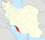 | ||||||||||||||||||||
| Counties and cities |
| ||||||||||||||||||||
| Landmarks |
| ||||||||||||||||||||
| populated places | |||||||||||||||||||||
| Capital | |||||||||||||||||||||
|---|---|---|---|---|---|---|---|---|---|---|---|---|---|---|---|---|---|---|---|---|---|
| Districts |
| ||||||||||||||||||||