
Arjay, Kentucky | |
|---|---|
 Houses along the railroad track in Arjay, 1946. Photo by Russell Lee. | |
 Arjay, Kentucky | |
| Coordinates: 36°48′17″N 83°38′45″W / 36.80472°N 83.64583°W | |
| Country | United States |
| State | Kentucky |
| County | Bell |
| Area | |
| • Total | 0.62 sq mi (1.61 km2) |
| • Land | 0.62 sq mi (1.61 km2) |
| • Water | 0.00 sq mi (0.00 km2) |
| Elevation | 1,066 ft (325 m) |
| Population (2020) | |
| • Total | 183 |
| • Density | 295.16/sq mi (113.97/km2) |
| Time zone | UTC-5 (Eastern (EST)) |
| • Summer (DST) | UTC-4 (EDT) |
| ZIP code | 40902 |
| Area code | 606 |
| GNIS feature ID | 486025[2] |
Arjay is an unincorporated community and coal town in Bell County, Kentucky, United States. Arjay is located on Kentucky Route 66 4 miles (6.4 km) northeast of Pineville.[3] Arjay has a post office with ZIP code 40902, which opened on February 23, 1911.[4][5] The community's name comes from the initials of coal operator R. J. Asher.[6]
Demographics
| Census | Pop. | Note | %± |
|---|---|---|---|
| 2020 | 183 | — | |
| U.S. Decennial Census[7] | |||
References
- ^ "2020 U.S. Gazetteer Files". United States Census Bureau. Retrieved March 18, 2022.
- ^ a b "Arjay". Geographic Names Information System. United States Geological Survey, United States Department of the Interior.
- ^ State Primary Road System: Bell County (PDF) (Map). Kentucky Transportation Cabinet. 2012. Retrieved February 23, 2013.
- ^ United States Postal Service (2012). "USPS - Look Up a ZIP Code". Retrieved February 15, 2012.
- ^ "Postmaster Finder - Post Offices by ZIP Code". United States Postal Service. Archived from the original on April 28, 2019. Retrieved February 23, 2013.
- ^ Rennick, Robert M. (1987). Kentucky Place Names. University Press of Kentucky. p. 375. ISBN 9780813126319.
- ^ "Census of Population and Housing". Census.gov. Retrieved June 4, 2016.
Municipalities and communities of Bell County, Kentucky, United States | ||
|---|---|---|
| Cities | 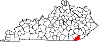 | |
| CDP | ||
| Other unincorporated communities |
| |
| Ghost towns | ||
| Footnotes | ‡This populated place also has portions in an adjacent county or counties | |
This Bell County, Kentucky state location article is a stub. You can help Wikipedia by expanding it. |