
Si Chomphu
สีชมพู | |
|---|---|
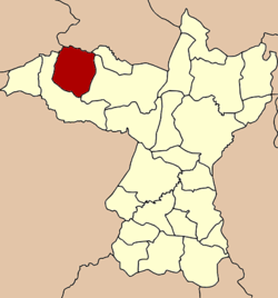 District location in Khon Kaen province | |
| Coordinates: 16°48′1″N 102°11′16″E / 16.80028°N 102.18778°E | |
| Country | Thailand |
| Province | Khon Kaen |
| Seat | Wang Phoem |
| Area | |
| • Total | 529.041 km2 (204.264 sq mi) |
| Population (2005) | |
| • Total | 78,220 |
| • Density | 147.9/km2 (383/sq mi) |
| Time zone | UTC+7 (ICT) |
| Postal code | 40220 |
| Geocode | 4006 |
Si Chomphu (Thai: สีชมพู, pronounced [sǐː t͡ɕʰōm.pʰūː]) is a district (amphoe) of Khon Kaen province, northeastern Thailand.
History
The district was established as a minor district (king amphoe) on 1 July 1965, when three tambons, Si Suk, Si Chomphu, and Na Chan were split from Chum Phae district.[1] It was upgraded to a full district on 1 March 1969.[2]
Geography
Neighboring districts are (from the north clockwise): Si Bun Rueang of Nong Bua Lamphu province; Nong Na Kham, Wiang Kao, and Chum Phae of Khon Kaen Province; and Phu Kradueng of Loei province.
Administration
The district is divided into 10 subdistricts (tambons), which are further subdivided into 107 villages (mubans). Si Chomphu is a township (thesaban tambon) and covers parts of tambon Wang Phoem. There are a further 10 tambon administrative organizations (TAO).
| No. | Name | Thai name | Villages | Pop. | |
|---|---|---|---|---|---|
| 1. | Si Chomphu | สีชมพู | 11 | 9,039 | |
| 2. | Si Suk | ศรีสุข | 15 | 11,109 | |
| 3. | Na Chan | นาจาน | 14 | 10,035 | |
| 4. | Wang Phoem | วังเพิ่ม | 13 | 11,377 | |
| 5. | Sam Yang | ซำยาง | 6 | 3,875 | |
| 6. | Nong Daeng | หนองแดง | 10 | 7,255 | |
| 7. | Dong Lan | ดงลาน | 9 | 7,691 | |
| 8. | Boribun | บริบูรณ์ | 12 | 7,111 | |
| 9. | Ban Mai | บ้านใหม่ | 10 | 5,619 | |
| 10. | Phu Han | ภูห่าน | 7 | 5,109 |
Attractions
- Wat Tham Saeng Tham, Tambon Boribun - A large Buddhist temple complex with a cave system inside the mountain. Inside the main cave has a marble floor. A large building is built on the outside of the mountain and the entrance has a grand gateway.[3]
- Wat Pha Nam Thiang, Tambon Boribun - Another Buddhist temple cave which is singular, large and high. There are free roaming monkeys.[4]
- Phu Wiang National Park, Wiang Kao, Phu Wiang, Si Chomphu and Chum Phae districts - The Park is noted for its dinosaur excavations.
References
- ^ ประกาศกระทรวงมหาดไทย เรื่อง แบ่งท้องที่ตั้งเป็นกิ่งอำเภอ (PDF). Royal Gazette (in Thai). 83 (59 ง): 2260. July 12, 1965. Archived from the original (PDF) on June 14, 2012.
- ^ พระราชกฤษฎีกาจัดตั้งอำเภอสมเด็จ อำเภอสีชมพู อำเภอหนองบัวแดง อำเภอบ้านแท่น อำเภอดอนตูม อำเภอนากลาง อำเภอศรีบุญเรือง และอำเภอป่าติ้ว พ.ศ. ๒๕๑๒ (PDF). Royal Gazette (in Thai). 86 (16 ก): 225–229. February 25, 1969. Archived from the original (PDF) on March 24, 2012.
- ^ Ellis, Martin, Caves of Eastern Thailand, Shepton Mallet – Somerset UK (2017)
- ^ Vogt, Nils, Temple Caves & Grottoes in Thailand, www.booksmango.com (2014)