
Ban Haet
บ้านแฮด | |
|---|---|
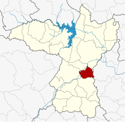 District location in Khon Kaen province | |
| Coordinates: 16°12′9″N 102°45′3″E / 16.20250°N 102.75083°E | |
| Country | Thailand |
| Province | Khon Kaen |
| Seat | Ban Haet |
| Area | |
| • Total | 205.2 km2 (79.2 sq mi) |
| Population (2005) | |
| • Total | 32,135 |
| • Density | 156.6/km2 (406/sq mi) |
| Time zone | UTC+7 (ICT) |
| Postal code | 40110 |
| Geocode | 4024 |
Ban Haet (Thai: บ้านแฮด, pronounced [bâːn hɛ̂(ː)t]) is a district (amphoe) of Khon Kaen province, northeastern Thailand.
History
The minor district (king amphoe) was established on 1 April 1995 with area split off from Ban Phai district.[1][2]
On 15 May 2007, all 81 minor districts in Thailand were upgraded to full districts.[3] With publication in the Royal Gazette on 24 August the upgrade became official.[4]
Geography
Neighboring districts are (from the south clockwise) Ban Phai, Mancha Khiri, Phra Yuen, Mueang Khon Kaen of Khon Kaen Province, and Kosum Phisai of Maha Sarakham province.
Administration
The district is divided into four sub-districts (tambons), which are further subdivided into 45 villages (mubans). The township (thesaban tambon) Ban Haet covers parts of tambon Ban Haet. There are a further four tambon administrative organizations (TAO).
| No. | Name | Thai name | Villages | Pop. | |
|---|---|---|---|---|---|
| 1. | Ban Haet | บ้านแฮด | 11 | 8,888 | |
| 2. | Khok Samran | โคกสำราญ | 16 | 9,014 | |
| 3. | Non Sombun | โนนสมบูรณ์ | 11 | 9,260 | |
| 4. | Nong Saeng | หนองแซง | 7 | 4,973 |
References
- ^ khonkaen.doae.go.th[permanent dead link]
- ^ ประกาศกระทรวงมหาดไทย เรื่อง แบ่งเขตท้องที่อำเภอบ้านไผ่ จังหวัดขอนแก่น ตั้งเป็นกิ่งอำเภอบ้านแฮด (PDF). Royal Gazette (in Thai). 112 (Special 9 ง): 64. March 22, 1995. Archived from the original (PDF) on February 24, 2012.
- ^ แถลงผลการประชุม ครม. ประจำวันที่ 15 พ.ค. 2550 (in Thai). Manager Online. Archived from the original on 2011-05-16. Retrieved 2007-09-25.
- ^ พระราชกฤษฎีกาตั้งอำเภอฆ้องชัย...และอำเภอเหล่าเสือโก้ก พ.ศ. ๒๕๕๐ (PDF). Royal Gazette (in Thai). 124 (46 ก): 14–21. August 24, 2007. Archived from the original (PDF) on September 30, 2007.