
Ban Fang
บ้านฝาง | |
|---|---|
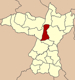 District location in Khon Kaen province | |
| Coordinates: 16°27′12″N 102°38′18″E / 16.45333°N 102.63833°E | |
| Country | Thailand |
| Province | Khon Kaen |
| Seat | Ban Fang |
| Area | |
| • Total | 334.0 km2 (129.0 sq mi) |
| Population (2005) | |
| • Total | 52,999 |
| • Density | 158.7/km2 (411/sq mi) |
| Time zone | UTC+7 (ICT) |
| Postal code | 40270 |
| Geocode | 4002 |
Ban Fang (Thai: บ้านฝาง, pronounced [bâːn fǎːŋ]) is a district (amphoe) of Khon Kaen province, northeastern Thailand.
YouTube Encyclopedic
-
1/3Views:4504 692633
-
FANG DISTRICT _ NORTHWEST THAILAND- Moto-vlog-
-
Aerial Drone in Fang District of Chiang Mai
-
Rain forest near Fang/ Thailand
Transcription
History
The minor district (king amphoe) Ban Fang was established on 1 May 1975 by splitting off four tambons: Nong Bua, Pa Wai Nang, Ban Lao, and Non Khong from Mueang Khon Kaen district.[1] On 25 March 1979 it was upgraded to a full district.[2][3]
Geography
Neighboring districts are (from the north clockwise): Ubolratana, Mueang Khon Kaen, Phra Yuen, Mancha Khiri, and Nong Ruea.
Administration
The district is divided into seven sub-districts (tambons), which are further subdivided into 74 villages (mubans). The township (thesaban tambon) Ban Fang covers parts of tambon Ban Fang. There are a further seven tambon administrative organizations (TAO).
| No. | Name | Thai name | Villages | Pop. | |
|---|---|---|---|---|---|
| 1. | Nong Bua | หนองบัว | 11 | 6,962 | |
| 2. | Pa Wai Nang | ป่าหวายนั่ง | 9 | 7,856 | |
| 3. | Non Khong | โนนฆ้อง | 10 | 6,055 | |
| 4. | Ban Lao | บ้านเหล่า | 13 | 10,133 | |
| 5. | Pa Manao | ป่ามะนาว | 9 | 6,173 | |
| 6. | Ban Fang | บ้านฝาง | 12 | 10,296 | |
| 7. | Khok Ngam | โคกงาม | 10 | 5,524 |
References
- ^ ประกาศกระทรวงมหาดไทย เรื่อง แบ่งท้องที่อำเภอเมืองขอนแก่น จังหวัดขอนแก่น ตั้งเป็นกิ่งอำเภอบ้านฝาง (PDF). Royal Gazette (in Thai). 92 (89 ง): 1141. 6 May 1975. Archived from the original (PDF) on 4 May 2012.
- ^ พระราชกฤษฎีกาตั้งอำเภอหนองกุงศรี อำเภอไทรงาม อำเภอบ้านฝาง อำเภออุบลรัตน์ อำเภอเวียงชัย อำเภอดอยเต่า อำเภอนิคมคำสร้อย อำเภอนาหว้า อำเภอเสิงสาง อำเภอศรีสาคร อำเภอบึงสามพัน อำเภอนาดูน อำเภอค้อวัง อำเภอโพธิ์ชัย อำเภอเมืองสรวง อำเภอปลวกแดง อำเภอยางชุมน้อย อำเภอกาบเชิง อำเภอสุวรรณคูหา และอำเภอกุดข้าวปุ้น พ.ศ. ๒๕๒๒ (PDF). Royal Gazette (in Thai). 96 (42 ก Special): 19–24. 25 March 1979. Archived from the original (PDF) on 30 September 2007.
- ^ khonkaen.doae.go.th[permanent dead link]