
Akpınar District | |
|---|---|
 Village of Büyükabdiuşağı | |
 Map showing Akpınar District in Kırşehir Province | |
 Akpınar District Location in Turkey  Akpınar District Akpınar District (Turkey Central Anatolia) | |
| Coordinates: 39°26′N 33°58′E / 39.433°N 33.967°E | |
| Country | Turkey |
| Province | Kırşehir |
| Seat | Akpınar |
| Government | |
| • Kaymakam | Yunus Emre Polat |
| Area | 582 km2 (225 sq mi) |
| Population (2022) | 6,893 |
| • Density | 12/km2 (31/sq mi) |
| Time zone | UTC+3 (TRT) |
| Website | www |
Akpınar District is a district of the Kırşehir Province of Turkey. Its seat is the town of Akpınar.[1] Its area is 582 km2,[2] and its population is 6,893 (2022).[3]
Composition
There is one municipality in Akpınar District:[1]
There are 26 villages in Akpınar District:[4]
- Alişar
- Aşağıhomurlu
- Boyalık
- Büyükabdiuşağı
- Çalıburnu
- Çayözü
- Çebişler
- Çelebiuşağı
- Çiftlikmehmetağa
- Çiftliksarıkaya
- Demirci
- Deveci
- Durmuşlu
- Eldeleklidemirel
- Eldelekliortaoba
- Eşrefli
- Gülveren
- Hacımirza
- Hacıselimli
- Hanyerisarıkaya
- Himmetuşağı
- Karaova
- Kelismailuşağı
- Köşker
- Pekmezci
- Sofrazlı
References
- ^ a b İlçe Belediyesi, Turkey Civil Administration Departments Inventory. Retrieved 1 March 2023.
- ^ "İl ve İlçe Yüz ölçümleri". General Directorate of Mapping. Retrieved 1 March 2023.
- ^ "Address-based population registration system (ADNKS) results dated 31 December 2022, Favorite Reports" (XLS). TÜİK. Retrieved 13 March 2023.
- ^ Köy, Turkey Civil Administration Departments Inventory. Retrieved 1 March 2023.
Akpınar District in Kırşehir Province of Turkey | |||||||||||||||||||||||||||
|---|---|---|---|---|---|---|---|---|---|---|---|---|---|---|---|---|---|---|---|---|---|---|---|---|---|---|---|
| Districts |  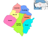 | ||||||||||||||||||||||||||
|
Metropolitan municipalities are bolded. | |||||||||||||||||||||||||||
This geographical article about a location in Kırşehir Province, Turkey is a stub. You can help Wikipedia by expanding it. |