
Akçakent District | |
|---|---|
 Map showing Akçakent District in Kırşehir Province | |
 Akçakent District Location in Turkey  Akçakent District Akçakent District (Turkey Central Anatolia) | |
| Coordinates: 39°37′N 34°05′E / 39.617°N 34.083°E | |
| Country | Turkey |
| Province | Kırşehir |
| Seat | Akçakent |
| Government | |
| • Kaymakam | Hüseyin Aydın |
| Area | 370 km2 (140 sq mi) |
| Population (2022) | 3,519 |
| • Density | 9.5/km2 (25/sq mi) |
| Time zone | UTC+3 (TRT) |
| Website | www |
Akçakent District is a district of the Kırşehir Province of Turkey. Its seat is the town of Akçakent.[1] Its area is 370 km2,[2] and its population is 3,519 (2022).[3]
The district was formed in 1990.[4]
Composition
There is one municipality in Akçakent District:[1]
There are 20 villages in Akçakent District:[5]
- Avanoğlu
- Ayvalı
- Derefakılı
- Güllühüyük
- Hacıfakılı
- Hamzabey
- Hasanali
- Kilimli
- Kösefakılı
- Küçükabdiuşağı
- Mahsenli
- Ödemişli
- Ömeruşağı
- Polatlı
- Solakuşağı
- Taşoluk
- Tepefakılı
- Yaylaözü
- Yeşildere
- Yetikli
References
- ^ a b İlçe Belediyesi, Turkey Civil Administration Departments Inventory. Retrieved 1 March 2023.
- ^ "İl ve İlçe Yüz ölçümleri". General Directorate of Mapping. Retrieved 1 March 2023.
- ^ "Address-based population registration system (ADNKS) results dated 31 December 2022, Favorite Reports" (XLS). TÜİK. Retrieved 13 March 2023.
- ^ "İl İdaresi ve Mülki Bölümler Şube Müdürlüğü İstatistikleri - İl ve İlçe Kuruluş Tarihleri" (PDF) (in Turkish). p. 54. Retrieved 27 December 2022.
- ^ Köy, Turkey Civil Administration Departments Inventory. Retrieved 1 March 2023.
Akçakent District in Kırşehir Province of Turkey | |||||||||||||||||||||||||||
|---|---|---|---|---|---|---|---|---|---|---|---|---|---|---|---|---|---|---|---|---|---|---|---|---|---|---|---|
| Districts |  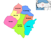 | ||||||||||||||||||||||||||
|
Metropolitan municipalities are bolded. | |||||||||||||||||||||||||||
This geographical article about a location in Kırşehir Province, Turkey is a stub. You can help Wikipedia by expanding it. |