
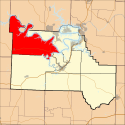
Adair Township | |
|---|---|
 | |
| Coordinates: 38°06′34″N 092°52′31″W / 38.10944°N 92.87528°W | |
| Country | United States |
| State | Missouri |
| County | Camden |
| Area | |
| • Total | 106.93 sq mi (276.96 km2) |
| • Land | 98.44 sq mi (254.96 km2) |
| • Water | 8.49 sq mi (22 km2) 7.94% |
| Elevation | 869 ft (265 m) |
| Population (2010) | |
| • Total | 5,062 |
| • Density | 47.3/sq mi (18.3/km2) |
| FIPS code | 29-00190[2] |
| GNIS feature ID | 0766388 |
Adair Township is one of eleven townships in Camden County, Missouri, USA. At the 2010 census, its population was 5,062.
Adair Township was erected in 1841.[3]
Geography
Adair Township covers an area of 106.93 square miles (276.9 km2) and contains one incorporated settlement, Climax Springs. It contains nine cemeteries: Adkins, Barnumton, Cable Ridge, Clark, Dority, Granger, Parish, Whitaker and Woolery.
The streams of Bollinger Creek, Dry Branch, Fiery Fork, Jack Branch, Kolb Branch, Lick Creek, Morriss Creek, Pearson Branch, Rainy Creek, Rise Branch, Ritter Branch, Spring Valley Creek and West Pearson Branch run through this township, and it contains multiple smaller springs.
Public areas
Adair Township contains the Moles Cave State Wildlife Area and Fiery Fork State Wildlife Area, which has canoe access to the Little Niangua River. It also contains the Climax Springs Lookout Tower.
Transportation
Adair Township contains one airport or landing strip, Eagles Landing Airport. It also contains Missouri Route 7, and Missouri Supplemental Routes CC, DD, J, NN, and Z.
References
- ^ "US Board on Geographic Names". United States Geological Survey. 25 October 2007. Retrieved 31 January 2008.
- ^ "U.S. Census website". United States Census Bureau. Retrieved 31 January 2008.
- ^ "Camden County Place Names, 1928–1945". The State Historical Society of Missouri. Archived from the original on 24 June 2016. Retrieved 8 September 2016.
External links
Municipalities and communities of Camden County, Missouri, United States | ||
|---|---|---|
| Cities |  | |
| Villages | ||
| Townships | ||
| CDPs | ||
| Other communities | ||
| Footnotes | ‡This populated place also has portions in an adjacent county or counties | |
This Camden County, Missouri state location article is a stub. You can help Wikipedia by expanding it. |