
İbradı | |
|---|---|
District and municipality | |
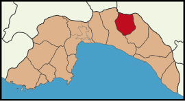 Map showing İbradı District in Antalya Province | |
 İbradı Location in Turkey | |
| Coordinates: 37°05′47″N 31°35′46″E / 37.09639°N 31.59611°E | |
| Country | Turkey |
| Province | Antalya |
| Government | |
| • Mayor | Hatice Sekmen (AKP) |
| Area | 778 km2 (300 sq mi) |
| Population (2022)[1] | 2,875 |
| • Density | 3.7/km2 (9.6/sq mi) |
| Time zone | UTC+3 (TRT) |
| Area code | 0242 |
| Website | www |
İbradı is a municipality and district of Antalya Province, Turkey.[2] Its area is 778 km2,[3] and its population is 2,875 (2022).[1]
İbradı is a high plain in the Taurus Mountains. In summer the weather is dry and cooler than the nearby Mediterranean coast with a daytime temperature of 30 degrees C and 10 degrees C at night. The mountains are covered with forests of juniper, cedar and pine, watered by mountain streams that eventually form the Manavgat River. The people of İbradı mainly live from grazing goats on the hillsides and from forestry; there is no commercial farming although people have gardens, vineyards and fruit trees.
YouTube Encyclopedic
-
1/3Views:4 56724 7702 377
-
İbradı Ve Çevre Doğası - Antalya
-
Altınbeşik Mağarası - Ürünlü - İbradı
-
ibradı-çukurviran 2008
Transcription
History
This area was once part of the antique kingdom of Pisidia, near the river Melas. It is unclear however when the district was first settled.
In the Turkish period the area was an important passage over the Taurus Mountains for traders from the Mediterranean, and was used as a summer retreat from the heat on the coast. There are the foundations of a Seljuk Turkish caravanserai in the district of Kesikbel.
People who live in Ibradi districts today are mainly Teke Turkmens. Same root with today's Teke Turkmens from Turkmenistan. They are member of Oghuz Salur Tribe.
Composition
There are 9 neighbourhoods in İbradı District:[4]
- Aşağı
- Aydınyayla
- Başlar
- Çukurviran
- Düzlen
- Ormana
- Ürünlü
- Üzümdere
- Yukarı
Places of interest
- The cave of Düdensuyu - not yet open to the public
- A number of Hellenistic and Ancient Roman sites, including the ruins of the city of Erymna (Ormana)
- Some historic houses in the town of Ormana.
There are of course many places for climbing and mountain walking.
References
- ^ a b "Address-based population registration system (ADNKS) results dated 31 December 2022, Favorite Reports" (XLS). TÜİK. Retrieved 22 May 2023.
- ^ Büyükşehir İlçe Belediyesi, Turkey Civil Administration Departments Inventory. Retrieved 8 June 2023.
- ^ "İl ve İlçe Yüz ölçümleri". General Directorate of Mapping. Retrieved 22 May 2023.
- ^ Mahalle, Turkey Civil Administration Departments Inventory. Retrieved 22 May 2023.
External links
İbradı in Antalya Province of Turkey | |||||||||||||||||||||||||||
|---|---|---|---|---|---|---|---|---|---|---|---|---|---|---|---|---|---|---|---|---|---|---|---|---|---|---|---|
| Districts |   | ||||||||||||||||||||||||||
|
Metropolitan municipalities are bolded. | |||||||||||||||||||||||||||
This geographical article about a location in Antalya Province, Turkey is a stub. You can help Wikipedia by expanding it. |