
Döşemealtı | |
|---|---|
District and municipality | |
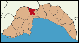 Map showing Döşemealtı District in Antalya Province | |
 Döşemealtı Location in Turkey | |
| Coordinates: 37°01′25″N 30°36′04″E / 37.02361°N 30.60111°E | |
| Country | Turkey |
| Province | Antalya |
| Government | |
| • Mayor | Turgay Genç (CHP) |
| Area | 687 km2 (265 sq mi) |
| Population (2022)[1] | 79,495 |
| • Density | 120/km2 (300/sq mi) |
| Time zone | UTC+3 (TRT) |
| Area code | 0242 |
| Website | www |

Döşemealtı is a municipality and district of Antalya Province, Turkey.[2] Its area is 687 km2,[3] and its population is 79,495 (2022).[1] Döşemealtı is situated 20 kilometres (12 mi) north of Antalya city center on the Turkish state highway D.650. The name of the city refers to an ancient road around the town (In Turkish Döşeme means "pavement" ) Döşemealtı is a recent settlement. The earliest residents were from Korkuteli (Burdur Province) in 1934. Later people from Cyprus and Yörüks (nomadic Turkmens) were also settled in Döşemealtı.[4] It was declared as seat of township in 1972 and a district center within Greater Antalya in 1998.
YouTube Encyclopedic
-
1/2Views:4301 987
-
Gizli Sulu Obruk Doğası Döşemealtı Antalya
-
Dağbeli Kasabası Döşemealtı Antalya 4K UHD
Transcription
Composition
There are 32 neighbourhoods in Döşemealtı District:[5]
References and notes
- ^ a b "Address-based population registration system (ADNKS) results dated 31 December 2022, Favorite Reports" (XLS). TÜİK. Retrieved 22 May 2023.
- ^ Büyükşehir İlçe Belediyesi, Turkey Civil Administration Departments Inventory. Retrieved 8 June 2023.
- ^ "İl ve İlçe Yüz ölçümleri". General Directorate of Mapping. Retrieved 22 May 2023.
- ^ Mayor's page (in Turkish)
- ^ Mahalle, Turkey Civil Administration Departments Inventory. Retrieved 22 May 2023.
Döşemealtı in Antalya Province of Turkey | |||||||||||||||||||||||||||
|---|---|---|---|---|---|---|---|---|---|---|---|---|---|---|---|---|---|---|---|---|---|---|---|---|---|---|---|
| Districts |   | ||||||||||||||||||||||||||
|
Metropolitan municipalities are bolded. | |||||||||||||||||||||||||||