
Town of LaSalle, Colorado | |
|---|---|
 Entering LaSalle from the south on U.S. Route 85. | |
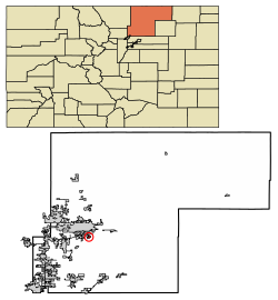 Location of the Town of LaSalle in Weld County, Colorado. | |
| Coordinates: 40°21′2″N 104°42′10″W / 40.35056°N 104.70278°W | |
| Country | |
| State | |
| County[1] | Weld |
| Incorporated (town) | 1910[2] |
| Government | |
| • Type | Statutory Town[1] |
| Area | |
| • Total | 0.96 sq mi (2.48 km2) |
| • Land | 0.96 sq mi (2.48 km2) |
| • Water | 0.00 sq mi (0.00 km2) |
| Elevation | 4,678 ft (1,426 m) |
| Population | |
| • Total | 2,359 |
| • Density | 2,500/sq mi (950/km2) |
| Time zone | UTC-7 (Mountain (MST)) |
| • Summer (DST) | UTC-6 (MDT) |
| ZIP code[6] | 80645 |
| Area code | 970 |
| FIPS code | 08-43605 |
| GNIS feature ID | 0180726 |
| Website | Town of LaSalle |
The Town of LaSalle (incorporated in 1910 as the Town of La Salle) is a Statutory Town in Weld County, Colorado, United States. The town population was 2,359 at the 2020 United States Census.[5]
A post office called La Salle has been in operation since 1886.[7] The community was named by railroad officials after LaSalle Street in Chicago.[8]
YouTube Encyclopedic
-
1/1Views:362
-
Colorado Wall Map - Not Too Shabby!
Transcription
Geography
LaSalle is located at 40°21′2″N 104°42′10″W / 40.35056°N 104.70278°W (40.350681, -104.702914).[9]
According to the United States Census Bureau, the town has a total area of 0.7 square miles (1.8 km2), all of it land.
Demographics
| Census | Pop. | Note | %± |
|---|---|---|---|
| 1920 | 460 | — | |
| 1930 | 564 | 22.6% | |
| 1940 | 755 | 33.9% | |
| 1950 | 797 | 5.6% | |
| 1960 | 1,070 | 34.3% | |
| 1970 | 1,227 | 14.7% | |
| 1980 | 1,929 | 57.2% | |
| 1990 | 1,783 | −7.6% | |
| 2000 | 1,849 | 3.7% | |
| 2010 | 1,955 | 5.7% | |
| 2020 | 2,359 | 20.7% |
See also
References
- ^ a b "Active Colorado Municipalities". State of Colorado, Department of Local Affairs. Archived from the original on December 12, 2009. Retrieved September 1, 2007.
- ^ "Colorado Municipal Incorporations". State of Colorado, Department of Personnel & Administration, Colorado State Archives. December 1, 2004. Retrieved September 2, 2007.
- ^ "2019 U.S. Gazetteer Files". United States Census Bureau. Retrieved July 1, 2020.
- ^ "US Board on Geographic Names". United States Geological Survey. October 25, 2007. Retrieved January 31, 2008.
- ^ a b United States Census Bureau. "La Salle town, Colorado". Retrieved April 19, 2023.
- ^ "ZIP Code Lookup". United States Postal Service. Archived from the original (JavaScript/HTML) on November 4, 2010. Retrieved October 23, 2007.
- ^ "Post offices". Jim Forte Postal History. Retrieved June 29, 2016.
- ^ Dawson, John Frank. Place names in Colorado: why 700 communities were so named, 150 of Spanish or Indian origin. Denver, CO: The J. Frank Dawson Publishing Co. p. 31.
- ^ "US Gazetteer files: 2010, 2000, and 1990". United States Census Bureau. February 12, 2011. Retrieved April 23, 2011.
External links
Municipalities and communities of Weld County, Colorado, United States | ||
|---|---|---|
| Cities |  | |
| Towns | ||
| CDPs | ||
| Unincorporated communities | ||
| Ghost towns | ||
| Trading posts | ||
| Footnotes | ‡This populated place also has portions in an adjacent county or counties | |
| International | |
|---|---|
| National | |