
Qsaibeh
القصيبة El Kossaybeh | |
|---|---|
Village | |
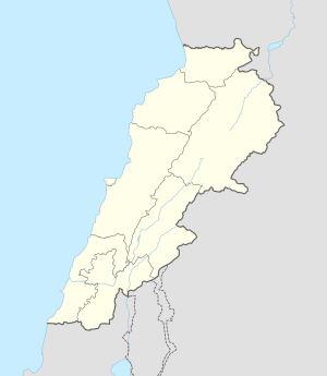 Qsaibeh Location in Lebanon | |
| Coordinates: 33°20′01″N 35°23′48″E / 33.33361°N 35.39667°E | |
| Grid position | 118/155 L |
| Country | |
| Governorate | Nabatieh Governorate |
| District | Nabatieh District |
| Government | |
| • Mayor | Hassan Rachid Mehdi |
| • Mayor | Najib Wehbe |
| Elevation | 1,300 ft (400 m) |
| Population (2011) | |
| • Total | 8,400 |
| Time zone | UTC+2 (EET) |
| • Summer (DST) | +3 |
| postal code | 71374 |
| Area code | +961 - (07 - South Lebanon) |
Qsaibeh, (النبطية), El Kossaybeh, also known as El Qsaïbé (in Arabic: القصيبة) is a village in southern Lebanon on the northern side of the Litani's river.
History
In the 1596 tax records, it was named as a village, Qusayba, in the Ottoman nahiya (subdistrict) of Sagif, part of Safad Sanjak, with a population of 26 households and 7 bachelors, all Muslim. The villagers paid a fixed tax-rate of 25 % on agricultural products, such as wheat, barley, olive trees, cotton, goats and beehives, in addition to "occasional revenues"; a total of 4,300 akçe.[1][2]
In 1875, Victor Guérin found here a village with 300 inhabitants, mostly Metualis and some Greek Orthodox. The mosque was possibly a former church.[3]
References
Bibliography
- Hütteroth, Wolf-Dieter; Abdulfattah, Kamal (1977). Historical Geography of Palestine, Transjordan and Southern Syria in the Late 16th Century. Erlanger Geographische Arbeiten, Sonderband 5. Erlangen, Germany: Vorstand der Fränkischen Geographischen Gesellschaft. ISBN 3-920405-41-2.
- Guérin, V. (1880). Description Géographique Historique et Archéologique de la Palestine (in French). Vol. 3: Galilee, pt. 2. Paris: L'Imprimerie Nationale.
- Rhode, H. (1979). Administration and Population of the Sancak of Safed in the Sixteenth Century. Columbia University.
External links
- Qsaibeh (Nabatiyeh), Localiban
| Capital | 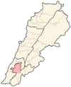 | |
|---|---|---|
| Towns and villages |
| |
| Other | ||