
| Mowry Slough | |
|---|---|
IUCN category IV (habitat/species management area) | |
 The Mowry Slough (lower center) where it meanders between salt ponds in the south San Francisco Bay, including the Don Edwards San Francisco Bay National Wildlife Refuge and the Dumbarton Bridge, with Peninsula cities in the background | |
 Mowry Slough  Mowry Slough  Mowry Slough | |
| Location | Fremont, California |
| Coordinates | 37°29′01″N 122°01′11″W / 37.4835499°N 122.0196838°W[1] |
| Designated | 1972 |
| Governing body | Don Edwards San Francisco Bay National Wildlife Refuge |
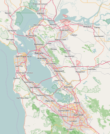
Mowry Slough[1] is a 5.8-mile-long (9.3 km)[2] slough in Don Edwards San Francisco Bay National Wildlife Refuge and is the primary breeding ground for San Francisco Bay harbor seals. It is situated among the salt marshes and salt evaporation ponds in the city of Fremont.[3][4]
YouTube Encyclopedic
-
1/1Views:1 438
-
California Colloquium on Water - Charles C. Benton
Transcription
See also
References
- ^ a b "Mowry Slough". Geographic Names Information System. United States Geological Survey, United States Department of the Interior. 19 January 1981. Retrieved 5 January 2017.
- ^ U.S. Geological Survey. National Hydrography Dataset high-resolution flowline data. The National Map, accessed March 15, 2011
- ^ SFSU Archived 2007-09-07 at the Wayback Machine, Mowry Slough, retrieved August 1, 2007
- ^ "Mowry Slough Watershed".
Historically one of the deepest sloughs in South San Francisco Bay, Mowry Slough meanders through the tidal marsh bounded by colorful salt ponds. It is named for Origin Mowry who, in the mid-1800s, owned over 400 acres of farmland in the area and used the slough to transport goods and people by boat. Mowry Slough is located in the Don Edwards San Francisco Bay National Wildlife Refuge and is accessible only by boat. Being so isolated, it is an ideal home for harbor seals, which are easily disturbed by human activities. A healthy population of harbor seals thrives there, raising their young and sunbathing on the banks of the salt marsh.
External links

This Alameda County, California–related article is a stub. You can help Wikipedia by expanding it. |