
Mühldorf am Inn | |
|---|---|
 The three churches of Mühldorf | |
 Coat of arms | |
Location of Mühldorf am Inn within Mühldorf am Inn district 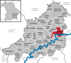 | |
 Mühldorf am Inn  Mühldorf am Inn | |
| Coordinates: 48°14′44″N 12°31′22″E / 48.24556°N 12.52278°E | |
| Country | Germany |
| State | Bavaria |
| Admin. region | Oberbayern |
| District | Mühldorf am Inn |
| Subdivisions | 4 Stadtteile |
| Government | |
| • Mayor (2020–26) | Michael Hetzl[1] |
| Area | |
| • Total | 29.42 km2 (11.36 sq mi) |
| Elevation | 384 m (1,260 ft) |
| Population (2022-12-31)[2] | |
| • Total | 21,697 |
| • Density | 740/km2 (1,900/sq mi) |
| Time zone | UTC+01:00 (CET) |
| • Summer (DST) | UTC+02:00 (CEST) |
| Postal codes | 84453 |
| Dialling codes | 08631 |
| Vehicle registration | MÜ |
| Website | www.muehldorf.de |
Mühldorf am Inn (Central Bavarian: Muihdorf am Inn) is a town in Bavaria, Germany, and the capital of the district Mühldorf on the river Inn. It is located at 48°14′30″N 12°31′30″E / 48.24167°N 12.52500°E, and had a population of about 17,808 in 2005.
YouTube Encyclopedic
-
1/3Views:16 4337311 856
-
So schön ist Mühldorf a. Inn
-
Faschingsumzug Mühldorf 2017
-
Thank God it's Friday! Sinners Club Mühldorf, 02.12.2011 (eraffe.de)
Transcription
History
During the Middle Ages, the town and castle were an alod of the Luchen family. On 28 October 1287, Rapoto Luchen announced that he had entered an agreement with Archbishop Rudolph of Salzburg to hand over the alod, become the archbishop's ministerialis, and thereafter run the lands as a fief of the Prince-Archbishops of Salzburg.[3]
On 28 September 1322, the decisive Battle of Mühldorf was fought here between Bavaria and Salzburg. Before the battle, the Prince-Archbishop of Salzburg knighted several of the burghers of the town.[4]
In 1802, Mühldorf became part of Bavaria.[5]
During World War II, it was the site of the Mühldorf concentration camp complex. Several Allied air raids directed at the area were designed to target the rail links into Munich and disrupt the transportation of materiel from the "Innwerk" industrial park in Töging am Inn. Around 44 U.S. Air personnel are thought to have perished during the return flight following one of these raids. Civilian casualties are believed to be much higher due to many aircraft crews being unable to identify their primary objectives.
Climate
| Climate data for Mühldorf (1991–2020 normals) | |||||||||||||
|---|---|---|---|---|---|---|---|---|---|---|---|---|---|
| Month | Jan | Feb | Mar | Apr | May | Jun | Jul | Aug | Sep | Oct | Nov | Dec | Year |
| Mean daily maximum °C (°F) | 2.5 (36.5) |
4.7 (40.5) |
9.8 (49.6) |
15.3 (59.5) |
19.6 (67.3) |
23.0 (73.4) |
25.0 (77.0) |
24.7 (76.5) |
19.6 (67.3) |
14.0 (57.2) |
7.2 (45.0) |
3.2 (37.8) |
14.1 (57.4) |
| Daily mean °C (°F) | −0.9 (30.4) |
0.2 (32.4) |
4.4 (39.9) |
9.0 (48.2) |
13.7 (56.7) |
17.1 (62.8) |
18.5 (65.3) |
18.1 (64.6) |
13.4 (56.1) |
8.8 (47.8) |
3.7 (38.7) |
0.2 (32.4) |
8.9 (48.0) |
| Mean daily minimum °C (°F) | −4.2 (24.4) |
−4.1 (24.6) |
−0.7 (30.7) |
2.5 (36.5) |
7.4 (45.3) |
11.0 (51.8) |
12.3 (54.1) |
12.0 (53.6) |
8.0 (46.4) |
4.3 (39.7) |
0.3 (32.5) |
−2.8 (27.0) |
3.8 (38.8) |
| Average precipitation mm (inches) | 49.7 (1.96) |
42.0 (1.65) |
57.6 (2.27) |
46.4 (1.83) |
89.2 (3.51) |
96.9 (3.81) |
101.4 (3.99) |
93.3 (3.67) |
68.1 (2.68) |
58.0 (2.28) |
51.8 (2.04) |
54.5 (2.15) |
809.0 (31.85) |
| Average precipitation days (≥ 1.0 mm) | 15.3 | 13.9 | 15.0 | 11.9 | 15.2 | 15.7 | 15.4 | 14.5 | 14.4 | 14.8 | 14.6 | 16.3 | 176.9 |
| Average snowy days (≥ 1.0 cm) | 14.4 | 11.5 | 4.5 | 0.5 | 0 | 0 | 0 | 0 | 0 | 0.1 | 3.0 | 10.1 | 44.1 |
| Average relative humidity (%) | 88.1 | 84.4 | 78.6 | 72.5 | 73.0 | 74.8 | 75.0 | 77.1 | 83.0 | 87.1 | 91.1 | 90.1 | 81.2 |
| Mean monthly sunshine hours | 61.0 | 89.4 | 139.6 | 189.1 | 217.1 | 228.6 | 244.1 | 231.8 | 159.5 | 109.9 | 57.6 | 51.3 | 1,779 |
| Source: World Meteorological Organization[6] | |||||||||||||
References
- ^ Liste der ersten Bürgermeister/Oberbürgermeister in kreisangehörigen Gemeinden, Bayerisches Landesamt für Statistik, 15 July 2021.
- ^ Genesis Online-Datenbank des Bayerischen Landesamtes für Statistik Tabelle 12411-003r Fortschreibung des Bevölkerungsstandes: Gemeinden, Stichtag (Einwohnerzahlen auf Grundlage des Zensus 2011) (Hilfe dazu).
- ^ Freed, p. 206
- ^ Freed, p. 223
- ^ Heinz Dopsch u.a.: Mühldorf a. Inn - Salzburg in Bayern: 935-1802-2002
- ^ "World Meteorological Organization Climate Normals for 1991–2020". World Meteorological Organization Climatological Standard Normals (1991–2020). National Oceanic and Atmospheric Administration. Archived from the original on 12 October 2023. Retrieved 12 October 2023.
Further reading
Freed, John B. Noble Bondsmen: Ministerial Marriages in the Archdiocese of Salzburg, 1100-1343. (Ithaca, NY: Cornell University Press, 1995)
| International | |
|---|---|
| National | |
| Geographic | |
This Mühldorf district location article is a stub. You can help Wikipedia by expanding it. |