

Juraqan (Persian: جورقان)[a] is a city in the Central District of Hamadan County, Hamadan province, Iran, serving as the administrative center for Hegmataneh Rural District.[4]
At the 2006 census, its population was 8,851 in 2,311 households.[5] The following census in 2011 counted 9,262 people in 2,769 households.[6] The latest census in 2016 showed a population of 9,234 people in 3,042 households.[2]
YouTube Encyclopedic
-
1/1Views:20 950
-
Floods & Noah's in Ancient American Myths, Legends, and Oral Traditions / Black Deities, Coxcox
Transcription
Notes
References
- ^ OpenStreetMap contributors (17 October 2023). "Juraqan, Hamadan County" (Map). OpenStreetMap. Retrieved 17 October 2023.
- ^ a b "Census of the Islamic Republic of Iran, 1395 (2016)". AMAR (in Persian). The Statistical Center of Iran. p. 13. Archived from the original (Excel) on 21 April 2021. Retrieved 19 December 2022.
- ^ Juraqan can be found at GEOnet Names Server, at this link, by opening the Advanced Search box, entering "-3068209" in the "Unique Feature Id" form, and clicking on "Search Database".
- ^ Mousavi, Mirhossein. "Creation and formation of 38 rural districts including villages, farms and places in a part of Hamadan County under Hamadan province". Laws and Regulations Portal of the Islamic Republic of Iran (in Persian). Ministry of Interior, Cabinet of Ministers. Archived from the original on 21 May 2022. Retrieved 11 February 2024.
- ^ "Census of the Islamic Republic of Iran, 1385 (2006)". AMAR (in Persian). The Statistical Center of Iran. p. 13. Archived from the original (Excel) on 20 September 2011. Retrieved 25 September 2022.
- ^ "Census of the Islamic Republic of Iran, 1390 (2011)". Syracuse University (in Persian). The Statistical Center of Iran. p. 13. Archived from the original (Excel) on 17 January 2023. Retrieved 19 December 2022.
Hamadan Province, Iran | |||||||||||||||||||||
|---|---|---|---|---|---|---|---|---|---|---|---|---|---|---|---|---|---|---|---|---|---|
| Capital | 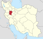 | ||||||||||||||||||||
| Counties and cities |
| ||||||||||||||||||||
| Sights |
| ||||||||||||||||||||
| populated places | |||||||||||||||||||||
| Capital | |||||||||||||||||||||||||||||||
|---|---|---|---|---|---|---|---|---|---|---|---|---|---|---|---|---|---|---|---|---|---|---|---|---|---|---|---|---|---|---|---|
| Districts |
| ||||||||||||||||||||||||||||||
This Hamadan County location article is a stub. You can help Wikipedia by expanding it. |