
Asadabad County
Persian: شهرستان اسدآباد | |
|---|---|
 Location of Asadabad County in Hamadan province (left, purple) | |
 Location of Hamadan province in Iran | |
| Coordinates: 34°48′N 48°04′E / 34.800°N 48.067°E[1] | |
| Country | |
| Province | Hamadan |
| Capital | Asadabad |
| Districts | Central, Pirsalman |
| Population (2016) | |
| • Total | 100,901 |
| Time zone | UTC+3:30 (IRST) |
| Asadabad County can be found at GEOnet Names Server, at this link, by opening the Advanced Search box, entering "-3823440" in the "Unique Feature Id" form, and clicking on "Search Database". | |
Asadabad County (Persian: شهرستان اسدآباد) is in Hamadan province, Iran. Its capital is the city of Asadabad.[2]
Demographics
Population
At the time of the 2006 National Census, the county's population was 104,566 in 25,167 households.[3] The following census in 2011 counted 107,006 people in 29,232 households.[4] At the 2016 census, the county's population was 100,901 in 30,387 households.[5]
Administrative divisions
Asadabad County's population history and administrative structure over three consecutive censuses are shown in the following table.
| Administrative Divisions | 2006[3] | 2011[4] | 2016[5] |
|---|---|---|---|
| Central District | 104,566 | 93,789 | 89,774 |
| Chaharduli RD | 9,367 | 9,291 | 8,003 |
| Darbandrud RD | 13,054 | 12,952 | 11,413 |
| Jolgeh RD | 6,669 | 3,722 | 3,138 |
| Kolyai RD | 3,909 | ||
| Pirsalman RD | 6,835 | ||
| Seyyed Jamal ol Din RD | 13,428 | 12,800 | 11,517 |
| Asadabad (city) | 51,304 | 55,024 | 55,703 |
| Pirsalman District | 12,739 | 10,825 | |
| Kolyai RD | 3,354 | 3,028 | |
| Pirsalman RD | 9,385 | 5,059 | |
| Ajin (city) | 2,738 | ||
| Total | 104,566 | 107,006 | 100,901 |
| RD = Rural District | |||
See also
![]() Media related to Asadabad County at Wikimedia Commons
Media related to Asadabad County at Wikimedia Commons
References
- ^ OpenStreetMap contributors (15 October 2023). "Asadabad County" (Map). OpenStreetMap. Retrieved 15 October 2023.
- ^ Habibi, Hassan (30 May 1369). "Details of the divisions of the law on the conversion of parts of Asadabad, Meybod, Mobarakeh to the city of..." Lamtakam (in Persian). Ministry of Interior, Defense Political Commission of the Government Board. Archived from the original on 19 December 2023. Retrieved 4 February 2024.
- ^ a b "Census of the Islamic Republic of Iran, 1385 (2006)". AMAR (in Persian). The Statistical Center of Iran. p. 13. Archived from the original (Excel) on 20 September 2011. Retrieved 25 September 2022.
- ^ a b "Census of the Islamic Republic of Iran, 1390 (2011)". Syracuse University (in Persian). The Statistical Center of Iran. p. 13. Archived from the original (Excel) on 17 January 2023. Retrieved 19 December 2022.
- ^ a b "Census of the Islamic Republic of Iran, 1395 (2016)". AMAR (in Persian). The Statistical Center of Iran. p. 13. Archived from the original (Excel) on 21 April 2021. Retrieved 19 December 2022.
Hamadan Province, Iran | |||||||||||||||||||||
|---|---|---|---|---|---|---|---|---|---|---|---|---|---|---|---|---|---|---|---|---|---|
| Capital | 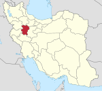 | ||||||||||||||||||||
| Counties and cities |
| ||||||||||||||||||||
| Sights |
| ||||||||||||||||||||
| populated places | |||||||||||||||||||||
| Capital | |||||||||||||||||||
|---|---|---|---|---|---|---|---|---|---|---|---|---|---|---|---|---|---|---|---|
| Districts |
| ||||||||||||||||||
This Hamadan province location article is a stub. You can help Wikipedia by expanding it. |