
Bala | |
|---|---|
District and municipality | |
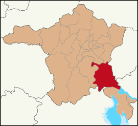 Map showing Bala District in Ankara Province | |
 Bala Location in Turkey  Bala Bala (Turkey Central Anatolia) | |
| Coordinates: 39°33′14″N 33°07′16″E / 39.55389°N 33.12111°E | |
| Country | Turkey |
| Province | Ankara |
| Government | |
| • Mayor | Ahmet Buran (AKP) |
| Area | 1,851 km2 (715 sq mi) |
| Elevation | 1,310 m (4,300 ft) |
| Population (2022)[1] | 20,521 |
| • Density | 11/km2 (29/sq mi) |
| Time zone | UTC+3 (TRT) |
| Postal code | 06720 |
| Area code | 0312 |
| Website | www |
Bala (also: Balâ), formerly known as Balbadon, is a municipality and district of Ankara Province, Turkey.[2] Its area is 1,851 km2,[3] and its population is 20,521 (2022).[1] It is 67 km south-east of the city of Ankara. Its elevation is 1,310 m (4,298 ft).
Bala stands on a high plain, summers are hot, winters are cold and snowy. The town of Bala is small but busy with shops and light manufacturing workshops, the surrounding countryside is used for farming, especially grains and sunflower seeds. Recently Ankara's wealthier citizens have begun building luxury housing in some villages of Bala. However the town stands on a fault line and experiences many earthquakes.


Places of interest
The forest of Beynam and the Kesikköprü reservoir are two of Ankara's most popular picnic spots.
Composition
There are 55 neighbourhoods in Bala District:[4]
- Abazlı
- Afşar
- Ahmetçayırı
- Akkoyunlu
- Aşağıhacıbekir
- Aşıkoğlu
- Aydoğan
- Bahçekaradalak
- Bektaşlı
- Belçarşak
- Beynam
- Büyükbayat
- Büyükbıyık
- Büyükboyalık
- Büyükcamili
- Çatalçeşme
- Çatalören
- Çiğdemli
- Davdanlı
- Derekışla
- Eğribasan
- Erdemli
- Ergin
- Göztepe
- Gülbağı
- Hamidiye
- Hanburun
- İsmetpaşa
- Karahamzalı
- Kartaltepe
- Kerişli
- Kesikköprü
- Kızılırmak
- Koçyayla
- Köseli
- Küçükbayat
- Küçükbıyık
- Küçükboyalık
- Küçükcamili
- Sarıhüyük
- Şehriban
- Şentepe
- Sırapınar
- Sofular
- Suyugüzel
- Tatarhüyük
- Tepeköy
- Tolköy
- Üçem
- Yaylalıözü
- Yeniköy
- Yeniyapançarşak
- Yeniyapanşeyhli
- Yöreli
- Yukarıhacıbekir
References
- ^ a b "Address-based population registration system (ADNKS) results dated 31 December 2022, Favorite Reports" (XLS). TÜİK. Retrieved 22 May 2023.
- ^ Büyükşehir İlçe Belediyesi, Turkey Civil Administration Departments Inventory. Retrieved 8 June 2023.
- ^ "İl ve İlçe Yüz ölçümleri". General Directorate of Mapping. Retrieved 22 May 2023.
- ^ Mahalle, Turkey Civil Administration Departments Inventory. Retrieved 22 May 2023.
External links
- District governor's official website (in Turkish)
- District municipality's official website (in Turkish)
- Kenthaber.com. "General information on Bala district of Ankara" (in Turkish). Archived from the original on 2007-12-25.
Bala, Ankara in Ankara Province of Turkey | |||||||||||||||||||||||||||
|---|---|---|---|---|---|---|---|---|---|---|---|---|---|---|---|---|---|---|---|---|---|---|---|---|---|---|---|
| Districts |   | ||||||||||||||||||||||||||
|
Metropolitan municipalities are bolded. | |||||||||||||||||||||||||||