
Çamlıdere | |
|---|---|
District and municipality | |
 | |
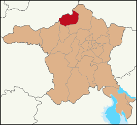 Map showing Çamlıdere District in Ankara Province | |
 Çamlıdere Location in Turkey  Çamlıdere Çamlıdere (Turkey Central Anatolia) | |
| Coordinates: 40°29′25″N 32°28′43″E / 40.49028°N 32.47861°E | |
| Country | Turkey |
| Province | Ankara |
| Government | |
| • Mayor | Adem Ceylan (Ind.) |
| Area | 782 km2 (302 sq mi) |
| Elevation | 1,240 m (4,070 ft) |
| Population (2022)[1] | 8,100 |
| • Density | 10/km2 (27/sq mi) |
| Time zone | UTC+3 (TRT) |
| Postal code | 06740 |
| Area code | 0312 |
| Website | www |
Çamlıdere is a municipality and district of Ankara Province, Turkey.[2] Its area is 782 km2,[3] and its population is 8,100 (2022).[1] It is 108 km north-west of the city of Ankara. Its elevation is 1,240 m (4,068 ft).
Çamlıdere was settled by the Seljuk Turks and there are a number of Seljuk period buildings in the area.
Many fossils and a petrified forest have been found in the area.
YouTube Encyclopedic
-
1/5Views:1 3106 5642 5781 8454 053
-
Çamlıdere / Ankara
-
Çamlıdere Buğralar Yaylası 'nda Kış Kampı 2022 - Köz Ateşinde Balık Çevirdik - Muhteşem Doğa
-
Cibilli Dede Çamlıdere / ANKARA
-
ÇAMKORU GÖLETİ/ÇAMLIDERE ÇAMKORU / ÇAMLIDERE YAYLALARI ANKARA PİKNİK VE KAMP ALANI EMİNE YABACIOĞLU
-
BELMA BELEN'LE GEZİYORUZ ÇAMLIDERE 1.Bölüm
Transcription
Demographics
The district of Çamlıdere experienced a rapid depopulation, especially in rural villages, like many other rural and remote areas in Central Anatolia.
| Year | Pop. | ±% p.a. |
|---|---|---|
| 1965 | 19,596 | — |
| 1980 | 18,521 | −0.38% |
| 1990 | 19,365 | +0.45% |
| 2000 | 15,339 | −2.30% |
| 2007 | 9,329 | −6.86% |
| 2012 | 6,739 | −6.30% |
| 2017 | 7,389 | +1.86% |
| 2022 | 8,100 | +1.85% |
| Source: TÜIK (2007-2022)[1] | ||
Composition
There are 48 neighbourhoods in Çamlıdere District:[5]
- Ahatlar
- Akkaya
- Alakoç
- Atça
- Avdan
- Avşarlar
- Bardakçılar
- Bayındır
- Beşbeyler
- Beyler
- Bökeler
- Buğralar
- Çamköy
- Çukurören
- Dağkuzören
- Doğancı
- Doğanlar
- Dörtkonak
- Doymuş
- Eldelek
- Elmalı
- Elören
- Elvanlar
- Gümele
- Güney
- İnceöz
- Kayabaşı
- Körler
- Kuşçular
- Kuyubaşı
- Meşeler
- Müsellim
- Muzrupağacın
- Ömerağa
- Örenköy
- Orta
- Osmansin
- Özmüş
- Peçenek
- Pelitçik
- Sarıkavak
- Tatlak
- Yahşihan
- Yahyalar
- Yayalar
- Yediören
- Yılanlı
- Yoncatepe
Çamlıdere today
This is an attractive woodland district with lakes, meadows, a deer park, a scout camp and many other places for camping, walking and picnics. In summertime Çamlıdere is busy with day-trippers from Ankara and there is a growing number of guest-houses for weekenders coming to enjoy the fresh air and open skies. The people in this rural area are typically conservative and religious in outlook.
The summer festival in July features oil-wrestling, music, dance, circumcisions of boys, and pilgrimage to the tomb of Sheikh Ali Semerkandi.
Places of interest
- The country house of former president İsmet İnönü.
References
- ^ a b c "Population Of SRE-1, SRE-2, Provinces and Districts". TÜIK. Retrieved 26 June 2023.
- ^ Büyükşehir İlçe Belediyesi, Turkey Civil Administration Departments Inventory. Retrieved 8 June 2023.
- ^ "İl ve İlçe Yüz ölçümleri". General Directorate of Mapping. Retrieved 22 May 2023.
- ^ Turkish Statistical Institute
- ^ Mahalle, Turkey Civil Administration Departments Inventory. Retrieved 22 May 2023.
External links
- District governor's official website (in Turkish)
- Governorship of Çamlıdere, Turkey. "General information on Çamlıdere district of Ankara" (in Turkish). Archived from the original on 2008-02-13.
Çamlıdere, Ankara in Ankara Province of Turkey | |||||||||||||||||||||||||||
|---|---|---|---|---|---|---|---|---|---|---|---|---|---|---|---|---|---|---|---|---|---|---|---|---|---|---|---|
| Districts |   | ||||||||||||||||||||||||||
|
Metropolitan municipalities are bolded. | |||||||||||||||||||||||||||