
| Tunapuna-Piarco | ||
|---|---|---|
| Región | ||
 St. Augustine.
| ||
 Tunapuna-Piarco Localización de Tunapuna-Piarco en Trinidad y Tobago | ||
 | ||
| Coordenadas | 10°38′00″N 61°23′00″O / 10.633333, -61.383333 | |
| Entidad | Región | |
| • País |
| |
| • Isla | Trinidad | |
| Población (2011) | ||
| • Total | 215 119 hab. | |
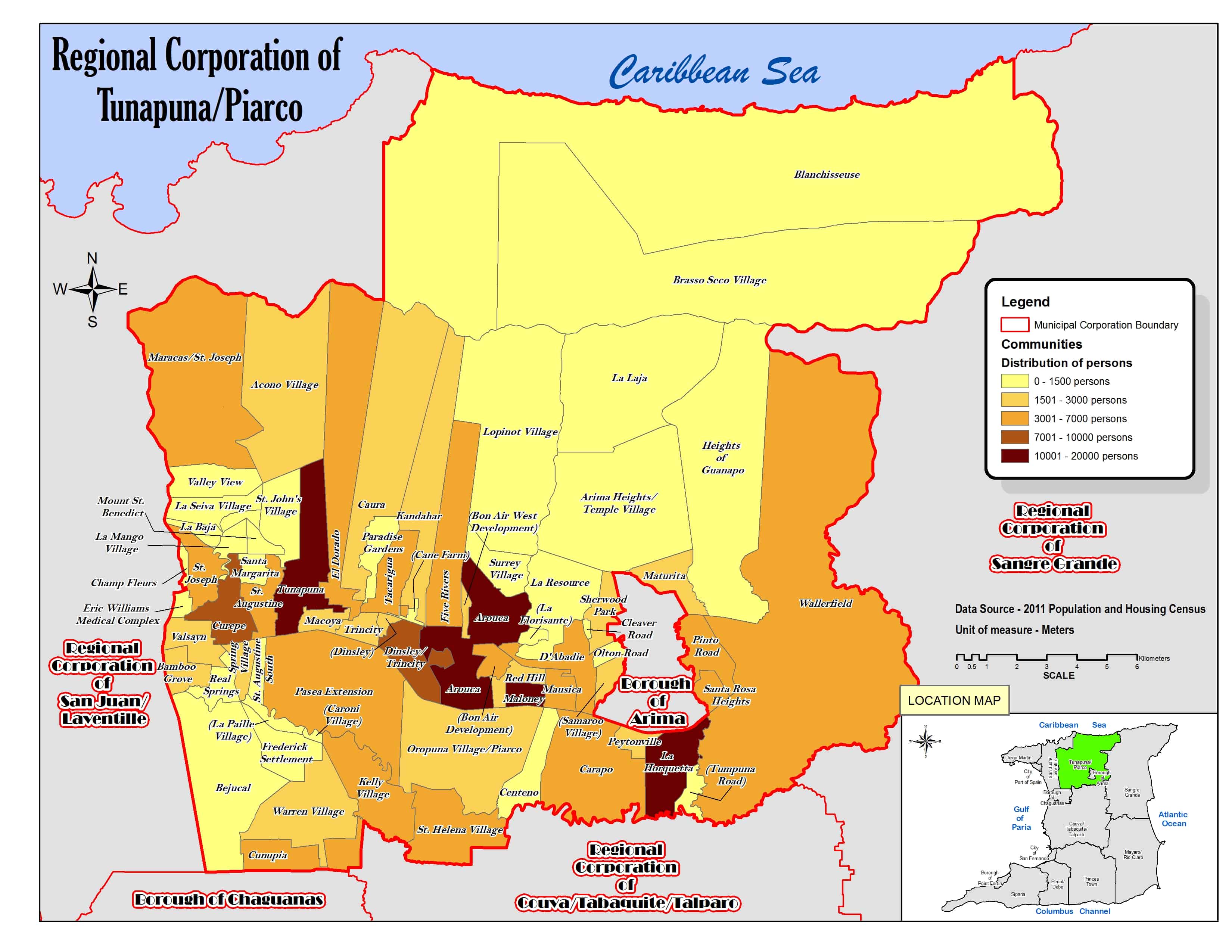
Tunapuna-Piarco es una región de Trinidad y Tobago.[1][2]
Geografía
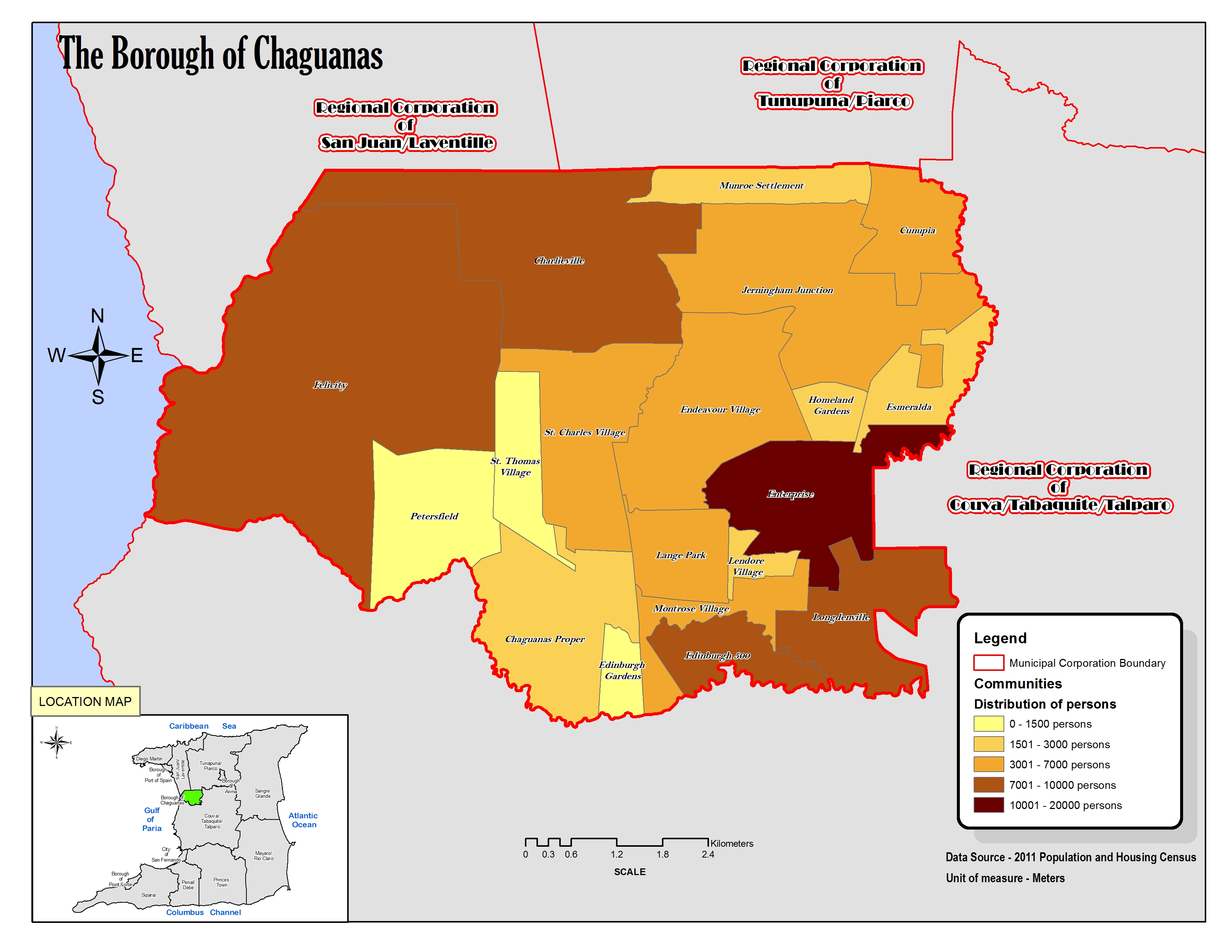
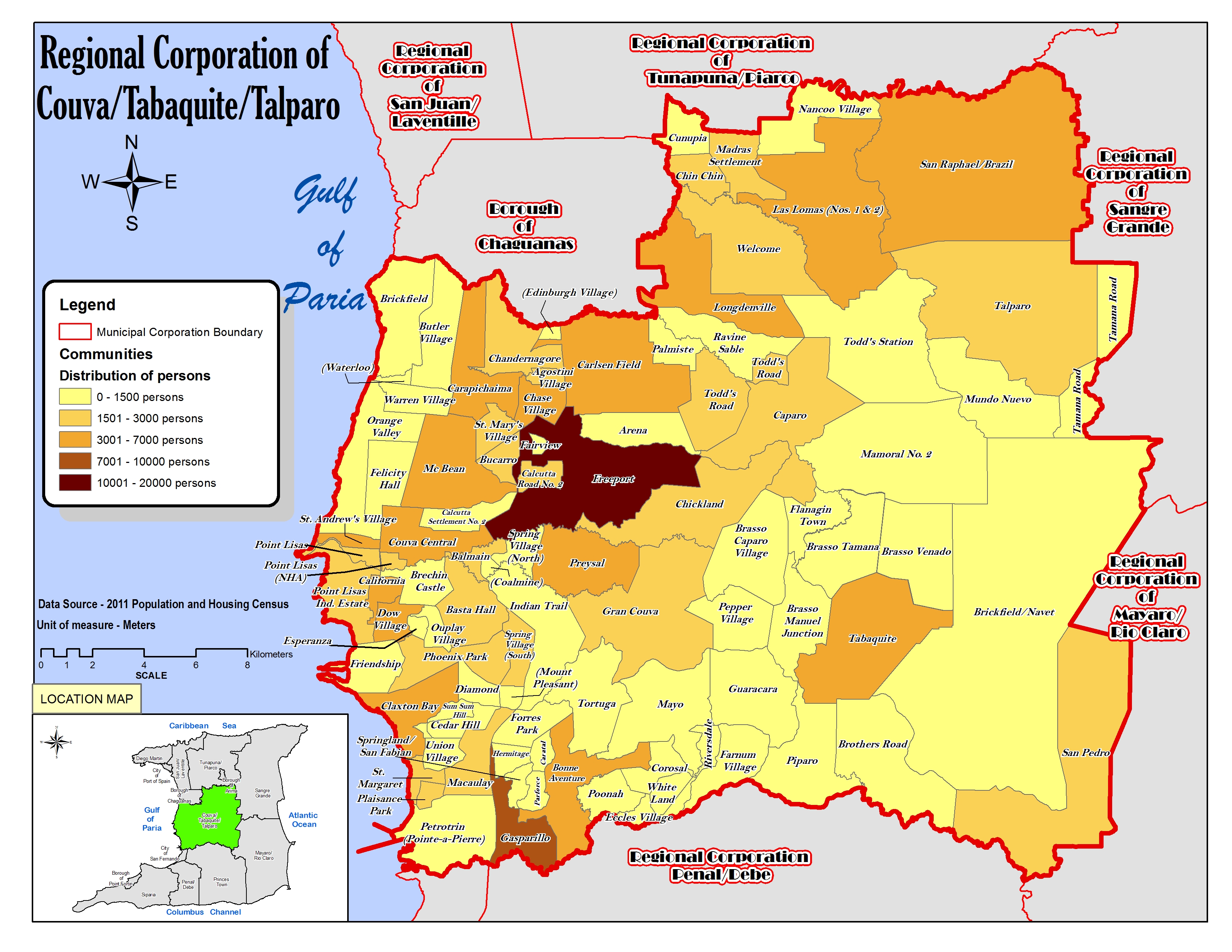
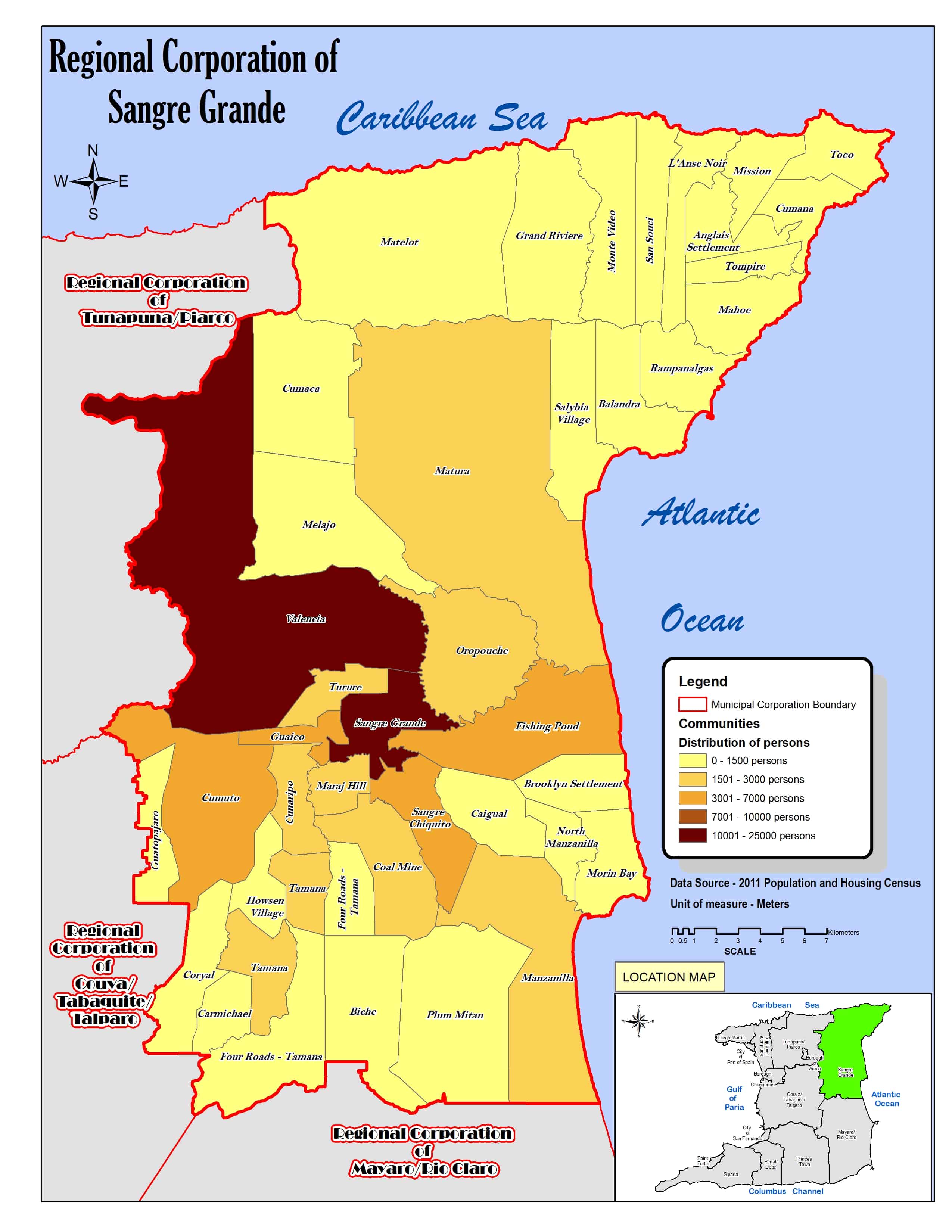
La región abarca parte de la isla Trinidad y limita al norte con el mar Caribe, al sur con el borough de Chaguanas[3] y la región de Couva-Tabaquite-Talparo,[4] al este con la región de Sangre Grande[5] y al oeste con la región de San Juan-Laventille.[6][7] Además, la región tiene enclavada el borough de Arima.[8][9]
Organización territorial
Consta de setenta localidades:[7][1]
- Acono Village
- Arima Heights-Temple Village
- Arouca
- Bamboo Grove (parcial)
- Bejucal (parcial)
- Blanchisseuse (parcial)
- Bon Air Development
- Bon Air West Development
- Brasso Seco Village
- Cane Farm
- Carapo
- Caroni Village
- Caura
- Centeno
- Champ Fleurs (parcial)
- Cleaver Road
- Cunupia (parcial)
- Curepe
- D'Abadie
- Dinsley
- Dinsley-Trincity
- El Dorado
- Eric Williams Medical Complex
- Five Rivers
- Frederick Settlement
- Heights of Guanapo
- Kandahar
- Kelly Village
- La Baja
- La Florisante
- La Horquetta
- La Laja
- La Mango Village
- La Paille Village
- La Resource
- La Seiva Village
- Lopinot Village
- Macoya
- Maloney Gardens
- Maracas-St. Joseph
- Maturita (parcial)
- Mausica
- Mount St. Benedict
- Olton Road
- Oropuna Village-Piarco
- Paradise Gardens
- Pasea Extension
- Peytonville
- Pinto Road
- Real Springs
- Red Hill
- Samaroo Village
- Santa Margarita
- Santa Rosa Heights
- Sherwood Park
- Spring Village
- St. Augustine
- St. Augustine South
- St. Helena Village
- St. John's Village
- St. Joseph
- Surrey Village
- Tacarigua
- Trincity
- Tumpuna Road
- Tunapuna
- Valley View
- Valsayn
- Wallerfield
- Warren Village
Demografía
Datos demográficos de la región de Tunapuna-Piarco:[1]
| Gráfica de evolución demográfica de Tunapuna-Piarco entre 2000 y 2011 |
 |
Referencias
- ↑ a b c «TRINIDAD AND TOBAGO. Municipalities and Communities: The population of the cities, boroughs, regions, parishes and communities of Trinidad and Tobago by census years.». Citypopulation.de (en inglés). 18 de mayo de 2020. Consultado el 24 de septiembre de 2023.
- ↑ «Population Statistics: Demographic Profiles of Municipalities and Communities.». CENTRAL STATISTICAL OFFICE. Ministry of Planning and Development (cso.gov.tt) (en inglés). 2023. Consultado el 24 de septiembre de 2023.
- ↑ «The Borough of Chaguanas. Location map.». cso.gov.tt (en inglés). 2011. Consultado el 24 de septiembre de 2023.
- ↑ «Regional Corporation of Couva/Tabaquite/Talparo. Location map.». cso.gov.tt (en inglés). 2011. Consultado el 24 de septiembre de 2023.
- ↑ «Regional Corporation of Sangre Grande. Location map.». cso.gov.tt (en inglés). 2011. Consultado el 24 de septiembre de 2023.
- ↑ «Regional Corporation of San Juan/Laventille. Location map.». cso.gov.tt (en inglés). 2011. Consultado el 24 de septiembre de 2023.
- ↑ a b «Regional Corporation of Tunapuna/Piarco. Location map.». cso.gov.tt (en inglés). 2011. Consultado el 24 de septiembre de 2023.
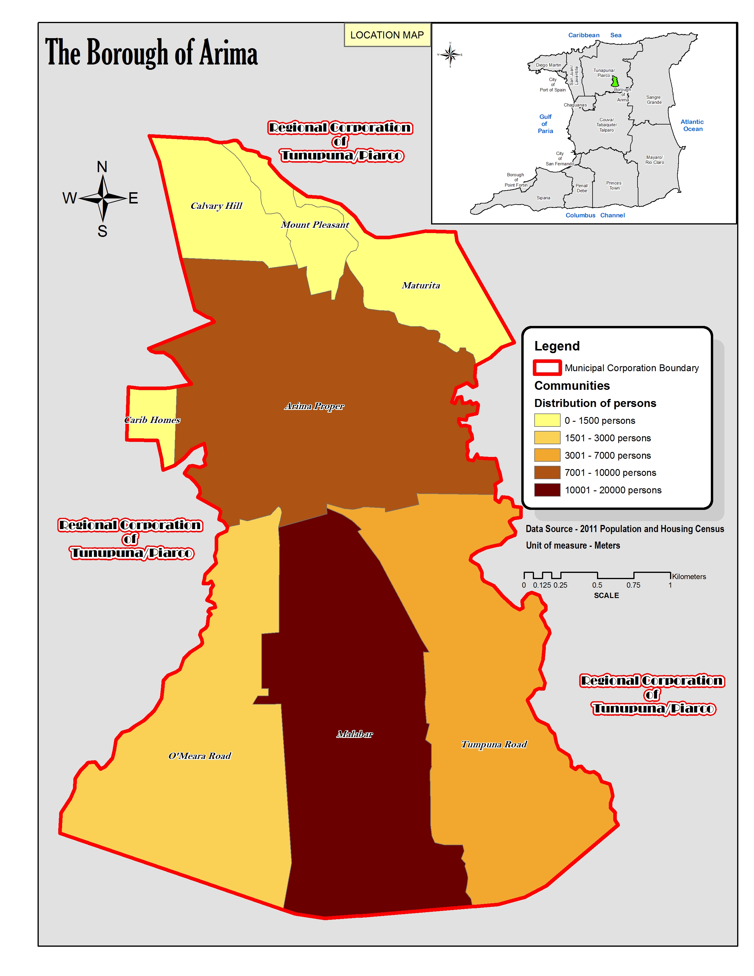
- ↑ «The Borough of Arima. Location map.». cso.gov.tt (en inglés). 2011. Consultado el 24 de septiembre de 2023.
- ↑ «Regional Corporation of Tunapuna/Piarco. Location map.». cso.gov.tt (en inglés). 2011. Consultado el 24 de septiembre de 2023.
Enlaces externos
 Wikimedia Commons alberga una categoría multimedia sobre Región corporativa de Tunapuna-Piarco.
| Control de autoridades |
|
|---|
 Datos: Q1899163
- Multimedia: Tunapuna-Piarco Regional Corporation / Q1899163