To install click the Add extension button. That's it.
The source code for the WIKI 2 extension is being checked by specialists of the Mozilla Foundation, Google, and Apple. You could also do it yourself at any point in time.
How to transfigure the Wikipedia
Would you like Wikipedia to always look as professional and up-to-date? We have created a browser extension. It will enhance any encyclopedic page you visit with the magic of the WIKI 2 technology.
Try it — you can delete it anytime.
Install in 5 seconds
Yep, but later
4,5
Kelly Slayton
Congratulations on this excellent venture… what a great idea!
Alexander Grigorievskiy
I use WIKI 2 every day and almost forgot how the original Wikipedia looks like.
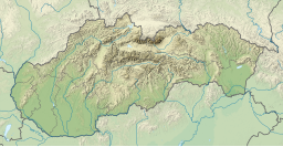
Zemplínska šírava (sometimes called the "Slovak sea" (Slovak: Slovenské more, Hungarian: Széles-tó). is a dam and lake in eastern Slovakia, near the town of Michalovce, wholly belonging to the Michalovce District. The name recalls the historical Zemplín region. The dam was built in 1961–1965, covers an area of 33 km2 (13 sq mi), has an average depth of 9.5 m (31 ft), with a maximum depth of 14 m (46 ft). Water from the dam flows into the Laborec river, which in turn flows into the Bodrog river. The area is primarily used for recreation. It also supplies cooling water for the Vojany Power Station.
YouTube Encyclopedic
1/3
Views:
2 753
365
13 134
Slovak sea - Zemplínska šírava and surroundings - July 2020
Zemplínska šírava and its abandoned hotels and shopping malls, Slovakia - july 2020
Zemplínska šírava (1970-1980)
Transcription
Panorama
Panorama of Zemplínska šírava and Vihorlat Mountains (Vihorlatské vrchy)


