To install click the Add extension button. That's it.

The source code for the WIKI 2 extension is being checked by specialists of the Mozilla Foundation, Google, and Apple. You could also do it yourself at any point in time.

4,5
Kelly Slayton
Congratulations on this excellent venture… what a great idea!
Alexander Grigorievskiy
I use WIKI 2 every day and almost forgot how the original Wikipedia looks like.
Live Statistics
English Articles
Improved in 24 Hours
Added in 24 Hours
Languages
Recent
Show all languages
What we do. Every page goes through several hundred of perfecting techniques; in live mode. Quite the same Wikipedia. Just better.
.
Leo
Newton
Brights
Milds

Zartlahn District

From Wikipedia, the free encyclopedia

Zartlahn District
District
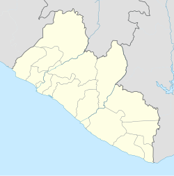
Zartlahn District is located in Liberia
Zartlahn District
Zartlahn District
Coordinates: 5°39′28″N 9°30′32″W / 5.65778°N 9.50889°W / 5.65778; -9.50889
CountryLiberia
CountyRivercess County
Elevation
94 m (308 ft)
Population
 (2008)
 • Total7,146
Time zoneUTC+0
Geocode9645149

Zartlahn District is one of 8 districts of Rivercess County, Liberia. As of 2008, the population was 7,146.[1]

Climate

Zarflahn District
Climate chart (explanation)
J
F
M
A
M
J
J
A
S
O
N
D
 
 
20
 
 
23
20
 
 
114
 
 
23
20
 
 
153
 
 
23
21
 
 
177
 
 
24
20
 
 
357
 
 
22
20
 
 
334
 
 
22
18
 
 
228
 
 
21
16
 
 
194
 
 
20
17
 
 
436
 
 
21
17
 
 
414
 
 
22
18
 
 
260
 
 
23
19
 
 
60
 
 
23
20
Average max. and min. temperatures in °C
Precipitation totals in mm
Source: [2]
Imperial conversion
JFMAMJJASOND
 
 
0.8
 
 
73
68
 
 
4.5
 
 
73
68
 
 
6
 
 
73
70
 
 
7
 
 
75
68
 
 
14
 
 
72
68
 
 
13
 
 
72
64
 
 
9
 
 
70
61
 
 
7.6
 
 
68
63
 
 
17
 
 
70
63
 
 
16
 
 
72
64
 
 
10
 
 
73
66
 
 
2.4
 
 
73
68
Average max. and min. temperatures in °F
Precipitation totals in inches


References

  1. ^ "2008 Population and Housing Census" (PDF). Government of the Republic of Liberia. May 11, 2009. Retrieved 2010-03-08.
  2. ^ "NASA Earth Observations Data Set Index". NASA. Retrieved 30 Jan 2016.


5°39′29″N 9°39′32″W / 5.658°N 9.659°W / 5.658; -9.659

This page was last edited on 22 June 2023, at 01:58
Basis of this page is in Wikipedia. Text is available under the CC BY-SA 3.0 Unported License. Non-text media are available under their specified licenses. Wikipedia® is a registered trademark of the Wikimedia Foundation, Inc. WIKI 2 is an independent company and has no affiliation with Wikimedia Foundation.