

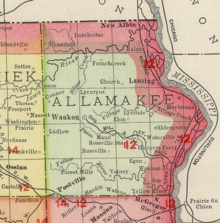
Waukon Junction is an unincorporated community in Allamakee County, Iowa, United States.[1]
YouTube Encyclopedic
-
1/1Views:53 873
-
Where in Iowa is Jeff?...The Sequel
Transcription
History
Waukon Junction got its start following construction of the railroad through that territory.[2] The community's population was 58 in 1902,[3] and 75 in 1925.[4]
References
- ^ U.S. Geological Survey Geographic Names Information System: Waukon Junction, Iowa
- ^ Ellery M. Hancock (1913). Past and Present of Allamakee County, Iowa: A Record of Settlement, Organization, Progress and Achievement. S. J. Clarke publishing Company. pp. 293.
- ^ Cram's Modern Atlas: The New Unrivaled New Census Edition. J. R. Gray & Company. 1902. pp. 203–207.
- ^ Company, Rand McNally and (1925). Premier Atlas of the World: Containing Maps of All Countries of the World, with the Most Recent Boundary Decisions, and Maps of All the States, Territories, and Possessions of the United States with Population Figures from the Latest Official Census Reports, Also Data of Interest Concerning International and Domestic Political Questions. Rand McNally & Company. p. 190.
Municipalities and communities of Allamakee County, Iowa, United States | ||
|---|---|---|
| Cities |  | |
| Townships | ||
| Unincorporated communities | ||
| Footnotes | ‡This populated place also has portions in an adjacent county or counties | |
This article about the geography of Allamakee County, Iowa is a stub. You can help Wikipedia by expanding it. |