| Watkins Glacier | |
|---|---|
| Type | Mountain glacier |
| Location | Siskiyou County, California, United States |
| Coordinates | 41°23′57″N 122°10′38″W / 41.39917°N 122.17722°W[1] |
| Area | .04 sq mi (0.10 km2) |
| Length | .2 mi (0.32 km) |
| Terminus | Moraine |
| Status | Expanding |
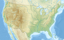
The Watkins Glacier is a glacier situated on the southeastern flank of Mount Shasta, in the U.S. state of California. It occupies a small cirque in the Clear Creek drainage. It is the smallest officially-named glacier on Mount Shasta, and it was not accorded that status until 1976, following a decades-long campaign by local resident R. Harry Watkins, Jr., to bring recognition to the previously-ignored glacier.[2]
The Watkins is one of three small cirque glaciers on the southern side of Shasta, along with the Konwakiton and Mud Creek Glaciers located about 1 mi (1.6 km) west. It has the lowest average elevation of any of Shasta's glaciers, extending only between 10,400 and 11,000 ft (3,200 and 3,400 m).[3]
In 2002, scientists made the first detailed survey of Mount Shasta's glaciers in 50 years. They found that seven of the glaciers (including the Watkins) have grown over the period 1951–2002, with the Hotlum and Wintun Glaciers nearly doubling, the Bolam Glacier increasing by half, and the Whitney and Konwakiton Glaciers growing by a third.[4][5][6]
See also
References
- ^ "Watkins Glacier". Geographic Names Information System. United States Geological Survey, United States Department of the Interior. Retrieved September 30, 2012.
- ^ "Existing Glaciers of Mount Shasta". College of the Siskiyous. Retrieved March 7, 2007.
- ^ Google Earth elevation for GNIS coordinates
- ^ Harris, Stephen L. (2005). Fire Mountains of the West: The Cascade and Mono Lake Volcanoes (3rd ed.). Mountain Press Publishing Company. p. 109. ISBN 0-87842-511-X.
- ^ Wong, Kathleen. "California Glaciers". California Wild. California Academy of Sciences. Archived from the original on October 6, 2006. Retrieved January 23, 2007.
- ^ Whitney, David (September 4, 2006). "A growing glacier: Mount Shasta bucks global trend, and researchers cite warming phenomena". The Bee. Archived from the original on January 21, 2007. Retrieved January 23, 2007.
- Driedger, Carolyn L.; Kennard, Paul M. (1986). "Ice volumes on Cascade volcanoes; Mount Rainier, Mount Hood, Three Sisters, and Mount Shasta". U.S. Geological Survey Professional Paper 1365. Retrieved March 6, 2007.
- "Glaciers of California". Glaciers of the American West. Glaciers Online. Archived from the original on July 15, 2007. Retrieved March 7, 2007.


