
Waretown, New Jersey | |
|---|---|
 Location of Waretown in Ocean County highlighted in red (right). Inset map: Location of Ocean County in New Jersey highlighted in black (left). | |
 Waretown Location in Ocean County 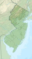 Waretown Location in New Jersey  Waretown Location in the United States | |
| Coordinates: 39°47′23″N 74°11′36″W / 39.789812°N 74.19327°W | |
| Country | |
| State | |
| County | Ocean |
| Township | Ocean |
| Area | |
| • Total | 0.95 sq mi (2.46 km2) |
| • Land | 0.92 sq mi (2.39 km2) |
| • Water | 0.02 sq mi (0.06 km2) 2.81% |
| Elevation | 10 ft (3 m) |
| Population | |
| • Total | 1,483 |
| • Density | 1,604.98/sq mi (619.60/km2) |
| Time zone | UTC−05:00 (Eastern (EST)) |
| • Summer (DST) | UTC−04:00 (Eastern (EDT)) |
| ZIP Code | 08758[4] |
| Area code | 609 |
| FIPS code | 34-76820[5][6][7] |
| GNIS feature ID | 02390452[5][8] |
Waretown is an unincorporated community and census-designated place (CDP) located on the Jersey Shore within Ocean Township, in Ocean County, in the U.S. state of New Jersey.[9][10][11][12] As of the 2020 United States census, the CDP's population was 1,483, a decrease of 86 (5.5%) from the 1,589 recorded at the 2010 United States Census,[13] which in turn had decreased by 13 (-0.8%) from the 1,582 counted at the 2000 census. Waretown is home to Albert Music Hall.[14]
Geography
According to the United States Census Bureau, the CDP had a total area of 0.925 square miles (2.395 km2), including 0.899 square miles (2.328 km2) of land and 0.026 square miles (0.067 km2) of water (2.81%).[5][15]
Demographics
| Census | Pop. | Note | %± |
|---|---|---|---|
| 1990 | 1,283 | — | |
| 2000 | 1,582 | 23.3% | |
| 2010 | 1,569 | −0.8% | |
| 2020 | 1,483 | −5.5% | |
| Population sources: 1990-2010[11] 2000[16] 2010[13] 2020[3] | |||
2010 census
The 2010 United States census counted 1,569 people, 644 households, and 458 families in the CDP. The population density was 1,745.9 per square mile (674.1/km2). There were 836 housing units at an average density of 930.2 per square mile (359.2/km2). The racial makeup was 97.77% (1,534) White, 0.45% (7) Black or African American, 0.00% (0) Native American, 0.51% (8) Asian, 0.06% (1) Pacific Islander, 0.25% (4) from other races, and 0.96% (15) from two or more races. Hispanic or Latino of any race were 2.36% (37) of the population.[13]
Of the 644 households, 23.3% had children under the age of 18; 56.2% were married couples living together; 10.1% had a female householder with no husband present and 28.9% were non-families. Of all households, 23.0% were made up of individuals and 11.2% had someone living alone who was 65 years of age or older. The average household size was 2.44 and the average family size was 2.89.[13]
17.7% of the population were under the age of 18, 8.5% from 18 to 24, 23.1% from 25 to 44, 31.1% from 45 to 64, and 19.6% who were 65 years of age or older. The median age was 45.4 years. For every 100 females, the population had 98.9 males. For every 100 females ages 18 and older there were 96.8 males.[13]
The Census Bureau's 2006-2010 American Community Survey showed that (in 2010 inflation-adjusted dollars) median household income was $78,750 (with a margin of error of +/- $4,931) and the median family income was $85,043 (+/- $13,392). Males had a median income of $53,438 (+/- $21,536) versus $31,172 (+/- $19,721) for females. The per capita income for the borough was $45,330 (+/- $18,923). About none of families and 4.4% of the population were below the poverty line, including 4.7% of those under age 18 and none of those age 65 or over.[17]
2000 Census
As of the 2000 United States Census[6] there were 1,582 people, 641 households, and 439 families living in the CDP. The population density was 656.8/km2 (1,694.4/mi2). There were 791 housing units at an average density of 328.4/km2 (847.2/mi2). The racial makeup of the CDP was 97.79% White, 0.44% African American, 0.06% Native American, 0.32% Asian, 0.06% from other races, and 1.33% from two or more races. Hispanic or Latino of any race were 2.28% of the population.[16]
There were 641 households, out of which 28.1% had children under the age of 18 living with them, 54.4% were married couples living together, 9.2% had a female householder with no husband present, and 31.5% were non-families. 26.4% of all households were made up of individuals, and 13.1% had someone living alone who was 65 years of age or older. The average household size was 2.47 and the average family size was 2.98.[5]
In the CDP the population was spread out, with 22.2% under the age of 18, 7.1% from 18 to 24, 29.1% from 25 to 44, 25.4% from 45 to 64, and 16.2% who were 65 years of age or older. The median age was 40 years. For every 100 females, there were 97.0 males. For every 100 females age 18 and over, there were 96.6 males.[5]
The median income for a household in the CDP was $44,410, and the median income for a family was $56,429. Males had a median income of $35,547 versus $26,667 for females. The per capita income for the CDP was $22,061. About 1.7% of families and 5.6% of the population were below the poverty line, including 5.1% of those under age 18 and 8.2% of those age 65 or over.[5]
Transportation

New Jersey Transit provides bus service to Atlantic City on the 559 bus route.[18] Numbered routes that run through the community include U.S. Route 9 and County Route 532. Waretown is served by exit 69 of the Garden State Parkway.
Notable people
People who were born in, residents of, or otherwise closely associated with Waretown include:
- George E. Smith (born 1930), winner of the 2009 Nobel Prize winner in Physics for his work on the charge-coupled device.[19]
References
- ^ "ArcGIS REST Services Directory". United States Census Bureau. Retrieved October 11, 2022.
- ^ U.S. Geological Survey Geographic Names Information System: Waretown Census Designated Place, Geographic Names Information System. Accessed January 11, 2013.
- ^ a b "Census Population API". United States Census Bureau. Retrieved October 11, 2022.
- ^ Look Up a ZIP Code for Waretown, NJ, United States Postal Service. Accessed May 2, 2012.
- ^ a b c d e f Gazetteer of New Jersey Places, United States Census Bureau. Accessed July 21, 2016.
- ^ a b U.S. Census website, United States Census Bureau. Accessed September 4, 2014.
- ^ Geographic Codes Lookup for New Jersey, Missouri Census Data Center. Accessed June 9, 2023.
- ^ US Board on Geographic Names, United States Geological Survey. Accessed September 4, 2014.
- ^ GCT-PH1 - Population, Housing Units, Area, and Density: 2010 - County -- County Subdivision and Place from the 2010 Census Summary File 1 for Ocean County, New Jersey Archived 2020-02-12 at archive.today, United States Census Bureau. Accessed January 11, 2013.
- ^ 2006-2010 American Community Survey Geography for New Jersey, United States Census Bureau. Accessed January 11, 2013.
- ^ a b New Jersey: 2010 - Population and Housing Unit Counts - 2010 Census of Population and Housing (CPH-2-32), United States Census Bureau, August 2012. Accessed January 11, 2013.
- ^ Locality Search, State of New Jersey. Accessed April 19, 2015.
- ^ a b c d e DP-1 - Profile of General Population and Housing Characteristics: 2010 Demographic Profile Data for Waretown CDP, New Jersey, United States Census Bureau. Accessed May 2, 2012.
- ^ "Albert Music Hall". County of Ocean. Retrieved July 8, 2023.
- ^ US Gazetteer files: 2010, 2000, and 1990, United States Census Bureau. Accessed September 4, 2014.
- ^ a b DP-1 - Profile of General Demographic Characteristics: 2000 from the Census 2000 Summary File 1 (SF 1) 100-Percent Data for Waretown CDP, New Jersey Archived 2020-02-12 at archive.today, United States Census Bureau. Accessed January 11, 2013.
- ^ DP03: Selected Economic Characteristics from the 2006-2010 American Community Survey 5-Year Estimates for Waretown CDP, New Jersey Archived 2020-02-12 at archive.today, United States Census Bureau. Accessed May 2, 2012.
- ^ Ocean County Bus / Rail Connections, New Jersey Transit, backed up by the Internet Archive as of July 26, 2010. Accessed January 13, 2013.
- ^ Staff. "NJ man's discovery lands Nobel Prize", WPVI-TV, October 6, 2009. Accessed March 23, 2012. "George E. Smith, 79, holds a display with a photograph of the first video telephone and some early CCD chips at his home in Waretown, N.J., Tuesday, Oct. 6, 2009, after it was announced that he had won the Nobel Prize in physics."
