
| Pegunungan Wondiboy Nature Reserve | |
|---|---|
| Wondiboy Mountains Nature Reserve | |
 Location of the peninsula in West Papua Province  Location of the peninsula in Western New Guinea | |
| Location | Teluk Wondama Regency, West Papua, Indonesia |
| Coordinates | 2°36′0″S 134°34′30″E / 2.60000°S 134.57500°E |
| Area | 795 km2 (307 sq mi) |
| Designation | Nature reserve |
| Governing body | Balai Besar Konservasi Sumber Daya Alam Papua Barat |
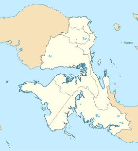
The Wondiboy Peninsula, also known as the Wondiwoi, Wandammen (spelled locally Wandamen), Wondama, or in old sources Mandamy[2][3] is a mountainous peninsula in Wondama Bay Regency, Western New Guinea. It extends northwards from the Bird's Neck Isthmus into Cenderawasih Bay. The mountains run north and south along the spine of the peninsula, rising from the shore up to 2,250 metres elevation, and extending southwards into the Bird's Neck Isthmus.[4] The eastern slope of the mountains is steeper than the western slope. Roon Island lies off the north end of the peninsula.
Lowland rain forest covers the lower slopes of the range, with montane rain forest at higher elevations. Lowland forests extend from sea level to approximately 1000 metres elevation. Lower montane forests are dominated by Castanopsis acuminatissima and species of laurels. Southern beech (Nothofagus spp.) is predominant in upper montane forests, and the trees are often covered in mosses and other epiphytes.[5]
Most of the Peninsula is covered by Pegunungan Wondiboy Nature Reserve, which covers an area of 795 km2 (307 sq mi).[1]
YouTube Encyclopedic
-
1/1Views:5 933
-
Western parotia / Parotia sefilata
Transcription
Etymology
The name Wandamen or Wondama comes from the Austronesian Wamesa language word Won meaning "people" and Dama meaning "come", so combined the word means, "the place where people come". Meanwhile Mandamy or Mandama comes from the Biak language with the same meaning.[3]
References
- ^ a b UNEP-WCMC (2024). Protected Area Profile for Pegunungan Wondiboy. World Database on Protected Areas. Retrieved 2 March 2024.
- ^ "Wondama". Wondama. Retrieved 2024-03-20.
- ^ a b "SEJARAH ASAL MUASAL NAMA WANDAMEN-WONDAMA". Manfasramdi. 2023-01-08. Retrieved 2024-03-20.
- ^ Diamond, Jared M. and Bishop, K. David. (2015). Avifaunas of the Kumawa and Fakfak Mountains, Indonesian New Guinea. Bulletin of the British Ornithologists' Club, Volume 135, Issue 4, 2015, pp. 292--336.
- ^ BirdLife International (2024) Endemic Bird Areas factsheet: West Papuan highlands. Retrieved 3 March 2024.
2°36′0″S 134°34′30″E / 2.60000°S 134.57500°E