
Wagontire, Oregon | |
|---|---|
 The Wagontire Cafe | |
 Wagontire  Wagontire | |
| Coordinates: 43°14′59″N 119°52′33″W / 43.24972°N 119.87583°W | |
| Country | United States |
| State | Oregon |
| County | Harney |
| Elevation | 4,737 ft (1,444 m) |
| Time zone | UTC-8 (PST) |
| • Summer (DST) | UTC-7 (PDT) |
| Area code | 541 |
| Coordinates and elevation from United States Geological Survey[1] | |
Wagontire is an unincorporated community in Harney County, Oregon, United States,[1] along U.S. Route 395.[2]
The community was named after nearby Wagontire Mountain.[3] From 1986 to at least 1997, Wagontire was home to just two people: William and Olgie Warner.[4] The Warners' property included a gas station, cafe, motel, general store, and recreational vehicle (RV) park.[5] Also there was Wagontire Airport, across the road from the buildings.[5] Planes flying into the airport taxied across the highway, and filled up at the gas station.[4]
In summer 1999, the community was purchased by Ellie Downing of Burns, who moved there with her nephew, Jerry Gray.[6]
Education
Wagontire is in Suntex School District 10 (Suntex School, grades K-8) and Harney County Union High School District 1J (Crane Union High School).[7][8]
References
- ^ a b "Wagontire". Geographic Names Information System. United States Geological Survey, United States Department of the Interior. November 28, 1980. Retrieved January 3, 2016.
- ^ "United States Topographic Map". United States Geological Survey. Retrieved January 3, 2016 – via Acme Mapper.
- ^ Moyer, Armond; Moyer, Winifred (1958). The origins of unusual place-names. Keystone Pub. Associates. p. 137.
- ^ a b Monroe, Bill (December 14, 1997). "Under the Desert Sky: Solitude for Sale". The Oregonian. pp. A01.
- ^ a b Weber, first (July 11, 1993). "Everyone Stops At Wagontire (Pop. 2)". The New York Times. Retrieved January 3, 2016.
- ^ Frazier, Joseph B. (April 2, 2000). "Life takes on a slow pace in Wagontire". Albany Democrat-Herald. Retrieved July 16, 2017.
- ^ "2020 CENSUS - SCHOOL DISTRICT REFERENCE MAP: Harney County, OR" (PDF). U.S. Census Bureau. p. 1(PDF p. 2/3). Retrieved March 11, 2024. (use the intersection of 395 and the county line) - Text list - Compare to the highway map.
- ^ "Harney County Sheet 4 of 11" (PDF). Oregon Department of Transportation. Retrieved March 11, 2024. - Wagontire indicated on the map. Compare with school district map.
External links
- Historic images of Wagontire from Salem Public Library

Municipalities and communities of Harney County, Oregon, United States | ||
|---|---|---|
| Cities | 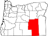 | |
| CDP | ||
| Other communities | ||
| Indian reservation | ||
| Ghost towns | ||
| Desert | ||
This Harney County, Oregon state location article is a stub. You can help Wikipedia by expanding it. |