
Uozu
魚津市 | |
|---|---|
 Top-Tateyama Mountains 1st row: Tatemon Festival, Ariso Dome 2nd row:Mirage Land, Buried Forest 3rd row:Uozu Aquarium, Uozu Station bottom:Mirage | |
 Flag  Seal | |
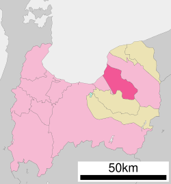 Location of Uozu in Toyama Prefecture | |
 Uozu | |
| Coordinates: 36°49′38.3″N 137°24′33″E / 36.827306°N 137.40917°E | |
| Country | Japan |
| Region | Chūbu (Kōshin'etsu) |
| Prefecture | Toyama |
| First official recorded | 701 AD |
| City Settled | April 1, 1952 |
| Area | |
| • Total | 200.61 km2 (77.46 sq mi) |
| Population (1 March 2016) | |
| • Total | 42,224 |
| • Density | 210/km2 (550/sq mi) |
| Time zone | UTC+9 (Japan Standard Time) |
| Phone number | 0765-23-1067 |
| Address | 1-10-1 Shakadō, Uozu-shi, Toyama-ken 937-8555 |
| Climate | Cfa |
| Website | www |
| Symbols | |
| Flower | Lilium speciosum, Azalea |
| Tree | Pinus |


Uozu (魚津市, Uozu-shi) is a city in the eastern part of Toyama Prefecture, Japan. As of 1 March 2018[update], the city had an estimated population of 42,224 in 16,811 households[1] and a population density of 210 persons per km2. Its total area was 200.61 square kilometres (77.46 sq mi).[2]
YouTube Encyclopedic
-
1/5Views:1 5633 9237992 1241 412
-
4K たてもん祭り 2018 Uozu Tatemon festival, Toyama
-
富山・魚津 たてもん祭り Tatemon festival Toyama Uozu
-
富山県・魚津市・魚津埋没林博物館( Uozu Buried Forest Museum in Uozu City Toyama Prefecture Japan )
-
4K たてもん祭り2017 Uozu Tatemon festival, Toyama
-
テイクアウトマルシェTOYAMA新庄店へ行ってみた‼︎
Transcription
Geography
Uozu lies in between Namerikawa and Kurobe, stretching from Toyama Bay and the Sea of Japan in the northwest to tall mountain ranges in the southeast. The highest mountains in Uozu are Sougadake and Kekachiyama, and the highest elevation in Uozu is 2,414 m. Several rapid rivers run through Uozu; from east to west, they are the Fuse River, the Katakai River, the Kado River, and the Hayatsuki River. Much of the area is a dispersed settlement typical of this region of Japan.
Surrounding municipalities
- Toyama Prefecture
Climate
Uozu has a humid continental climate (Köppen Cfa) characterized by mild summers and cold winters with heavy snowfall. The average annual temperature in Uozu is 13.7 °C. The average annual rainfall is 2278 mm with September as the wettest month. The temperatures are highest on average in August, at around 26.3 °C, and lowest in January, at around 2.4 °C.[3]
| Climate data for Uozu (1991−2020 normals, extremes 1978−present) | |||||||||||||
|---|---|---|---|---|---|---|---|---|---|---|---|---|---|
| Month | Jan | Feb | Mar | Apr | May | Jun | Jul | Aug | Sep | Oct | Nov | Dec | Year |
| Record high °C (°F) | 19.2 (66.6) |
22.4 (72.3) |
27.6 (81.7) |
30.7 (87.3) |
32.5 (90.5) |
33.1 (91.6) |
37.9 (100.2) |
37.8 (100.0) |
36.4 (97.5) |
33.5 (92.3) |
27.1 (80.8) |
24.9 (76.8) |
37.9 (100.2) |
| Mean daily maximum °C (°F) | 6.2 (43.2) |
6.8 (44.2) |
10.9 (51.6) |
16.8 (62.2) |
21.9 (71.4) |
25.0 (77.0) |
29.0 (84.2) |
30.6 (87.1) |
26.5 (79.7) |
21.0 (69.8) |
15.3 (59.5) |
9.4 (48.9) |
18.3 (64.9) |
| Daily mean °C (°F) | 2.7 (36.9) |
2.9 (37.2) |
6.2 (43.2) |
11.7 (53.1) |
16.9 (62.4) |
20.7 (69.3) |
24.7 (76.5) |
25.9 (78.6) |
21.9 (71.4) |
16.4 (61.5) |
10.7 (51.3) |
5.5 (41.9) |
13.9 (56.9) |
| Mean daily minimum °C (°F) | −0.3 (31.5) |
−0.5 (31.1) |
1.9 (35.4) |
6.8 (44.2) |
12.2 (54.0) |
16.8 (62.2) |
21.2 (70.2) |
22.1 (71.8) |
18.2 (64.8) |
12.3 (54.1) |
6.6 (43.9) |
2.0 (35.6) |
9.9 (49.9) |
| Record low °C (°F) | −8.8 (16.2) |
−9.3 (15.3) |
−7.1 (19.2) |
−1.8 (28.8) |
3.8 (38.8) |
8.3 (46.9) |
14.3 (57.7) |
14.6 (58.3) |
10.4 (50.7) |
2.8 (37.0) |
−1.0 (30.2) |
−6.7 (19.9) |
−9.3 (15.3) |
| Average precipitation mm (inches) | 254.7 (10.03) |
165.5 (6.52) |
176.8 (6.96) |
161.4 (6.35) |
154.0 (6.06) |
180.9 (7.12) |
276.1 (10.87) |
206.9 (8.15) |
233.6 (9.20) |
203.5 (8.01) |
255.1 (10.04) |
304.6 (11.99) |
2,588.3 (101.90) |
| Average snowfall cm (inches) | 133 (52) |
112 (44) |
21 (8.3) |
2 (0.8) |
0 (0) |
0 (0) |
0 (0) |
0 (0) |
0 (0) |
0 (0) |
1 (0.4) |
55 (22) |
325 (128) |
| Average precipitation days (≥ 1.0 mm) | 23.1 | 18.9 | 17.3 | 13.4 | 11.9 | 11.5 | 13.8 | 10.8 | 12.9 | 13.4 | 17.5 | 22.4 | 186.9 |
| Average snowy days (≥ 3 cm) | 11.8 | 10.9 | 2.2 | 0.2 | 0 | 0 | 0 | 0 | 0 | 0 | 0.1 | 5.2 | 30.4 |
| Mean monthly sunshine hours | 60.8 | 87.6 | 134.0 | 169.8 | 195.0 | 147.5 | 147.0 | 201.4 | 141.0 | 141.9 | 99.3 | 62.8 | 1,593.5 |
| Source: Japan Meteorological Agency[4][5] | |||||||||||||
Demographics
Per Japanese census data,[6] the population of Uozu has declined in recent decades.
| Year | Pop. | ±% |
|---|---|---|
| 1970 | 47,124 | — |
| 1980 | 49,512 | +5.1% |
| 1990 | 49,514 | +0.0% |
| 2000 | 47,136 | −4.8% |
| 2010 | 44,959 | −4.6% |
| 2020 | 40,535 | −9.8% |
History
The area of present-day Uotsu was part of ancient Etchū Province and has been inhabited since at least the Jōmon period. Discovery of gold in the mountains of Uozu around 1394 led to an influx of people, making the area around Matsukura Castle a center for the region. Later, when Matsukura Castle was destroyed, the center was reestablished around Uozu Castle close to the sea. In 1582, the Siege of Uozu occurred between forces allied to the Uesugi clan, and forces under Oda Nobunaga. Uozu Castle was captured by Oda forces only three days before Oda's assassination at the Honnō-ji incident.
Under the Edo period Tokugawa shogunate, Uozu was part of Kaga Domain ruled by the Maeda clan. The modern town of Uozu was established with the establishment of the municipalities system on 1 April 1889. The Taisho rice riots of 1918 began at Uozu before spreading across the country. Most of the western portion of the town was destroyed in a fire in 1943, but the town escaped damage in World War II. Uozu was raised to city status on 1 April 1952. In September 1956, a great fire ravished many buildings in Uozu.
Government
Uozu has a mayor-council form of government with a directly elected mayor and a unicameral city legislature of 18 members.
Education
Uozu has ten public elementary schools and two public junior high schools operated by the town government, and three public high schools operated by the Toyama Prefectural Board of Education. There is also one private high school.[citation needed]
Transportation
Uozu is located 3 hours by rail and 4.5 hours by car from Tokyo. Since March 2015, rail access is possible via Hokuriku Shinkansen high-speed train from nearby rail hub of Toyama. Uozu is served by two passenger train lines, the Toyama Chihō Railway Main Line and the Ainokaze Toyama Railway line, running together from Uozu Station westward and separating eastward.
Railway
Highway
Sister City relations
 Chiang Mai, Thailand,[7] since 8 August 1989
Notable people from Uozu, Toyama
- Kaori Sadohara, Japanese voice actress and singer
- Ayumu Ishikawa, Japanese professional baseball pitcher (Chiba Lotte Marines, Nippon Professional Baseball – Pacific League)
- Takashi Rakuyama, Japanese former football player
- Akira Shoji, Japanese former mixed martial artist and professional wrestler
- Akihiro Murata, Japanese professional shogi player ranked 6-dan
- Kōsuke Tamura, Japanese professional shogi player ranked 7-dan
Local attractions
Uozu's Three Mysteries
Mirages
The waters of Toyama Bay are noted for mirages, especially during spring and winter. The spring mirage for which Uozu is famous for may be seen on warm, sunny, windless days from April to June. The Mirage Land Amusement Park (ミラージュランド) with its large Ferris wheel is a popular location for observation of the phenomena.
Firefly Squid
In the early morning hours, from the end of March to the beginning of June, female firefly squid (ホタルイカ, hotaruika) rise to the surface to spawn. Their name comes from a bluish white glow which emanates from various points on their bodies.
The Buried Forest
Approximately 2000 years ago, a primeval sugi (Cryptomeria) forest along the coast was partially buried so that only the trunks were preserved. The area is a National Natural Monument, and there is a museum in Uotsu where examples can be seen.
Other
Other sightseeing destinations in Uozu include the Uozu Aquarium, Kintaro Hot Springs (金太郎温泉), Ariso Dome Gymnasium, Niikawa Culture Hall, the Uozu Historical Folk Museum, Lake Ikejiri, Hirazawa Waterfalls and site of Matsukura Castle.
References
- ^ Official statistics(in Japanese)
- ^ Uozu city introduction(in Japanese)
- ^ Uozu climate data
- ^ 観測史上1~10位の値(年間を通じての値). JMA. Retrieved 15 March 2022.
- ^ 気象庁 / 平年値(年・月ごとの値). JMA. Retrieved 15 March 2022.
- ^ Uozu population statistics
- ^ "International Exchange". List of Affiliation Partners within Prefectures. Council of Local Authorities for International Relations (CLAIR). Archived from the original on 8 February 2012. Retrieved 21 November 2015.
External links
- Official website (in Japanese)
| International | |
|---|---|
| National | |
| Core city | ||
|---|---|---|
| Cities | ||
| Districts | ||
| Former Districts | ||