
Funahashi
舟橋村 | |
|---|---|
 Funahashi Village Office | |
 Flag  Seal | |
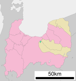 Location of Funahashi in Toyama Prefecture | |
 Funahashi | |
| Coordinates: 36°42′12.7″N 137°18′26.5″E / 36.703528°N 137.307361°E | |
| Country | Japan |
| Region | Chūbu (Hokuriku) |
| Prefecture | Toyama |
| District | Nakaniikawa |
| Area | |
| • Total | 3.47 km2 (1.34 sq mi) |
| Population (February 2024) | |
| • Total | 3,304 |
| • Density | 950/km2 (2,500/sq mi) |
| Time zone | UTC+9 (Japan Standard Time) |
| Symbols | |
| • Flower | Satsuki azalea |
| Address | 55 Busshōji, Funahashi-mura, Nakaniikawa-gun, Toyama-ken 930-0295 |
| Website | Official website |
Funahashi (舟橋村, Funahashi-mura) is a village located in Nakaniikawa District, Toyama Prefecture, Japan. As of 1 February 2024[update], the village had an estimated population of 3,304 in 1195 households[1] and a population density of 952 inhabitants per square kilometre (2,470/sq mi). The total area of the town was 3.47 square kilometres (1.34 sq mi), making it the smallest municipality in Japan in terms of area .[2]
Geography
Funahashi is located in central Toyama Prefecture.
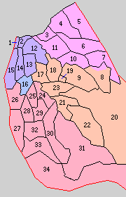
Surrounding municipalities
Climate
The town has a Humid subtropical climate (Köppen Cfa) characterized by hot summers and cold winters with heavy snowfall. The average annual temperature in Funahashi is 13.9 °C. The average annual rainfall is 2306 mm with September as the wettest month. The temperatures are highest on average in August, at around 26.4 °C, and lowest in January, at around 2.6 °C.[3]
Demographics
Per Japanese census data,[4] the population of Funahashi has more than doubled over the past 30 years.
| Year | Pop. | ±% |
|---|---|---|
| 1970 | 1,357 | — |
| 1980 | 1,360 | +0.2% |
| 1990 | 1,371 | +0.8% |
| 2000 | 2,153 | +57.0% |
| 2010 | 2,967 | +37.8% |
| 2020 | 3,132 | +5.6% |
History
The area of present-day Funahashi was part of ancient Etchū Province. The modern village of Funahashi was created with the establishment of the municipalities system on April 1, 1889. Funahashi is the only village left in Toyama prefecture, after any other villages were merged with towns or cities.
Economy
Agriculture (rice, edamame, acorn squash) was traditionally the mainstay of the local economy; however, the village has increasingly become a bedroom community for nearby Toyama.
Education
Funahashi has one public elementary school and one public middle school operated by the village government. The village does not have a high school.
Transportation
Railway
Highway
- The village is not on any national highway or expressway
References
- ^ Funahashi village official statistics(in Japanese)
- ^ 北陸地方で面積の大きい市町村上位10位及び面積の小さい市町村上位10位. Geospatial Information Authority of Japan (in Japanese). GSI. February 1, 2007. Retrieved September 3, 2011.
- ^ Funahashi climate data
- ^ Funahashi population statistics
External links
 Media related to Funahashi, Toyama at Wikimedia Commons
- Official website (in Japanese)
| International | |
|---|---|
| National | |
| Core city | ||
|---|---|---|
| Cities | ||
| Districts | ||
| Former Districts | ||
This Toyama location article is a stub. You can help Wikipedia by expanding it. |