
Tkuma
תקומה | |
|---|---|
 Village synagogue | |
 Tkuma  Tkuma | |
| Coordinates: 31°26′56″N 34°34′39″E / 31.448751°N 34.577422°E | |
| Country | Israel |
| District | Southern |
| Council | Sdot Negev |
| Affiliation | Hapoel HaMizrachi |
| Founded | 5–6 October 1946 |
| Founded by | Eastern European Jews |
| Population (2021)[1] | 737 |
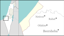
Tkuma (Hebrew: תְּקוּמָה, lit. 'Resurrection') is a religious moshav in southern Israel. Located north-west of Netivot, it falls under the jurisdiction of Sdot Negev Regional Council. In 2021 it had a population of 737.[1]
History
Tkuma was established as a kibbutz on the night of 5 and 6 October 1946 as one of the 11 points in the Negev at a location around a mile from the present site. The first residents were Jewish immigrants from Eastern Europe, who survived the Holocaust, and the village's name reflects the resurrection of Israel.[citation needed]
In 1949 the village moved to its present location near the site of the depopulated Arab village of al-Muharraqa. Scholar Benny Morris documents that Tkuma is near the al-Muharraqa site, but writer Walid Khalidi says that Tkuma, although only 2 km west of the al-Muharraqa site, is on land which once belonged to the city of Gaza.[2][3]
In the 1950s the moshav was joined by more immigrants from Eastern Europe and Tunisia.[citation needed]
Located 5 kilometers from Gaza, the moshav has suffered damage from rockets launched by Hamas militants during 2000s and 2010s. The moshav is serviced by the Color Red alert system.[4]

Economy
Since the 1990s, fish-farming has been an important economic branch. The sale of fresh fish to banquet halls and restaurants in the northern Negev has provided income for several families.[5]
Archaeology
In 1964, at Yizre'am, approximately 1 km southwest of Tkuma, a clay stamp bearing a Greek inscription was discovered, identifying it as belonging to "Silvanus".[6]
References
- ^ a b "Regional Statistics". Israel Central Bureau of Statistics. Retrieved 22 February 2023.
- ^ Morris, Benny (2004). The Birth of the Palestinian Refugee Problem Revisited. Cambridge: Cambridge University Press. p. xxi. ISBN 978-0-521-00967-6.
- ^ Khalidi, Walid (1992), All That Remains: The Palestinian Villages Occupied and Depopulated by Israel in 1948, Washington D.C.: Institute for Palestine Studies, p. 127, ISBN 0-88728-224-5
- ^ Kershner, Isabel (December 24, 2008). "Gaza Rocket Fire Intensifies". The New York Times. Retrieved April 17, 2019.
- ^ Heruti-Sover, Tali (January 18, 2009). "Gaza War Leads to Creative Marketing and Success". Haaretz. Retrieved April 17, 2019.
- ^ "XXXIII. Yizreʿam", Volume 3 South Coast: 2161-2648, De Gruyter, pp. 531–532, 2014-07-14, doi:10.1515/9783110337679.531, ISBN 978-3-11-033767-9, retrieved 2024-02-25
External links
- Tkuma Negev Information Centre