
Tilden | |
|---|---|
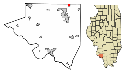 Location of Tilden in Randolph County, Illinois. | |
 Location of Illinois in the United States | |
| Coordinates: 38°12′45″N 89°41′0″W / 38.21250°N 89.68333°W | |
| Country | United States |
| State | Illinois |
| County | Randolph |
| Area | |
| • Total | 0.99 sq mi (2.55 km2) |
| • Land | 0.97 sq mi (2.52 km2) |
| • Water | 0.01 sq mi (0.03 km2) |
| Elevation | 522 ft (159 m) |
| Population (2020) | |
| • Total | 750 |
| • Density | 769.23/sq mi (297.05/km2) |
| Time zone | UTC-6 (CST) |
| • Summer (DST) | UTC-5 (CDT) |
| ZIP Code(s) | 62292 |
| Area code | 618 |
| FIPS code | 17-75263 |
| GNIS feature ID | 2399981[2] |
| Wikimedia Commons | Tilden, Illinois |
Tilden is a village in Randolph County, Illinois, United States. The population was 934 at the 2010 census.[3]
YouTube Encyclopedic
-
1/1Views:3 703
-
Hornet vs Parasite #viral #shorts #fyp
Transcription
Geography
Tilden is located at 38°12′45″N 89°41′00″W / 38.212516°N 89.683293°W (38.212516, -89.683293).[4]
According to the 2010 census, Tilden has a total area of 0.981 square miles (2.54 km2), of which 0.97 square miles (2.51 km2) (or 98.88%) is land and 0.011 square miles (0.03 km2) (or 1.12%) is water.[5]
Demographics
| Census | Pop. | Note | %± |
|---|---|---|---|
| 1880 | 83 | — | |
| 1910 | 774 | — | |
| 1920 | 1,137 | 46.9% | |
| 1930 | 981 | −13.7% | |
| 1940 | 1,040 | 6.0% | |
| 1950 | 906 | −12.9% | |
| 1960 | 808 | −10.8% | |
| 1970 | 909 | 12.5% | |
| 1980 | 1,025 | 12.8% | |
| 1990 | 919 | −10.3% | |
| 2000 | 922 | 0.3% | |
| 2010 | 934 | 1.3% | |
| 2020 | 750 | −19.7% | |
| U.S. Decennial Census[6] | |||
As of the census[7] of 2000, there were 922 people, 362 households, and 263 families residing in the village. The population density was 955.2 inhabitants per square mile (368.8/km2). There were 394 housing units at an average density of 408.2 units per square mile (157.6 units/km2). The racial makeup of the village was 99.13% White, 0.11% Native American, and 0.76% from two or more races. Hispanic or Latino of any race were 1.52% of the population.
There were 362 households, out of which 34.0% had children under the age of 18 living with them, 53.3% were married couples living together, 12.2% had a female householder with no husband present, and 27.3% were non-families. 23.2% of all households were made up of individuals, and 11.0% had someone living alone who was 65 years of age or older. The average household size was 2.55 and the average family size was 2.96.
In the village, the population was spread out, with 25.4% under the age of 18, 10.8% from 18 to 24, 26.8% from 25 to 44, 22.5% from 45 to 64, and 14.5% who were 65 years of age or older. The median age was 36 years. For every 100 females, there were 100.4 males. For every 100 females age 18 and over, there were 92.7 males.
The median income for a household in the village was $34,115, and the median income for a family was $37,500. Males had a median income of $28,125 versus $19,688 for females. The per capita income for the village was $14,738. About 12.4% of families and 14.7% of the population were below the poverty line, including 16.3% of those under age 18 and 8.7% of those age 65 or over.
References
- ^ "2020 U.S. Gazetteer Files". United States Census Bureau. Retrieved March 15, 2022.
- ^ a b U.S. Geological Survey Geographic Names Information System: Tilden, Illinois
- ^ "Profile of General Population and Housing Characteristics: 2010 Demographic Profile Data (DP-1): Tilden village, Illinois". United States Census Bureau. Retrieved January 4, 2012.
- ^ "US Gazetteer files: 2010, 2000, and 1990". United States Census Bureau. February 12, 2011. Retrieved April 23, 2011.
- ^ "G001 - Geographic Identifiers - 2010 Census Summary File 1". United States Census Bureau. Archived from the original on February 13, 2020. Retrieved December 25, 2015.
- ^ "Census of Population and Housing". Census.gov. Retrieved June 4, 2015.
- ^ "U.S. Census website". United States Census Bureau. Retrieved January 31, 2008.
External links
- Randolph County Herald Tribune, local newspaper
Municipalities and communities of Randolph County, Illinois, United States | ||
|---|---|---|
| Cities |  | |
| Villages | ||
| Precincts | ||
| Unincorporated communities | ||
| Authority control databases: National |
|---|