
Stadskanaal | |
|---|---|
Town and Municipality | |
 The canal in Stadskanaal | |
 Flag Coat of arms | |
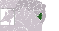 Location in Groningen | |
| Coordinates: 52°59′N 6°57′E / 52.983°N 6.950°E | |
| Country | Netherlands |
| Province | Groningen |
| Government | |
| • Body | Municipal council |
| • Mayor | Klaas Sloots (GL) |
| Area | |
| • Total | 119.94 km2 (46.31 sq mi) |
| • Land | 117.64 km2 (45.42 sq mi) |
| • Water | 2.30 km2 (0.89 sq mi) |
| Elevation | 6 m (20 ft) |
| Population (January 2021)[4] | |
| • Total | 31,754 |
| • Density | 270/km2 (700/sq mi) |
| Time zone | UTC+1 (CET) |
| • Summer (DST) | UTC+2 (CEST) |
| Postcode | 9500–9509, 9580–9599, 9660–9661 |
| Area code | 0599 |
| Website | www |
Stadskanaal (Dutch pronunciation: [ˌstɑtskaːˈnaːl] ⓘ) is a town and municipality with a population of 32,715 in the province of Groningen in the northeast of the Netherlands. It was named after the canal Stadskanaal.
From 1800 until 1900 this area was ideal for its peat mining, and so the canal came to ship all the peat to Groningen, the capital of the province.
In the Gronings dialect the town is called "Knoal" and the locals are called "Knoalsters".
Geography

The population centres in the municipality are:
- Alteveer
- Barlage
- Blekslage
- Braamberg
- Ceresdorp
- Höchte
- Holte
- Horsten
- Kopstukken
- Mussel
- Musselkanaal
- Onstwedde
- Oomsberg
- Smeerling
- Stadskanaal
- Sterenborg
- Ter Maarsch
- Ter Wupping
- Veenhuizen
- Vledderhuizen
- Vledderveen
- Vosseberg
- Wessinghuizen
International relations
Stadskanaal is twinned with
Gallery
-
 Stadskanaal, church: de Poststraatkerk
 -
 Stadskanaal, catholic church
 -
 Musselkanaal, church
 -
 Musselkanaal, drawbridge
Notable people

- Cornelis Dopper (1870 in Stadskanaal – 1939) a Dutch composer, conductor and teacher
- Charles de Wolff (1932 in Mussel – 2011) a Dutch organist and conductor
- Henk Wijngaard (born 1946 in Stadskanaal) a Dutch country singer
- Henk Bleker (born 1953 in Onstwedde) a retired Dutch politician and jurist
Sport
- Jannes Munneke (born 1949 in Musselkanaal) a retired Dutch rower, competed at the 1972 Summer Olympics
- Sylvia Smit (born 1986 in Stadskanaal) a Dutch female footballer
References
- ^ "Burgemeester" [Mayor] (in Dutch). Gemeente Stadskanaal. Retrieved 4 February 2014.
- ^ "Kerncijfers wijken en buurten 2020" [Key figures for neighbourhoods 2020]. StatLine (in Dutch). CBS. 24 July 2020. Retrieved 19 September 2020.
- ^ "Postcodetool for 9501SZ". Actueel Hoogtebestand Nederland (in Dutch). Het Waterschapshuis. Retrieved 4 February 2014.
- ^ "Bevolkingsontwikkeling; regio per maand" [Population growth; regions per month]. CBS Statline (in Dutch). CBS. 1 January 2021. Retrieved 2 January 2022.
- ^ "Bielsko-Biała - Partner Cities". © 2008 Urzędu Miejskiego w Bielsku-Białej. Retrieved 2008-12-10.
External links
Wikimedia Commons has media related to Stadskanaal.
Places adjacent to Stadskanaal | ||||||||||||||||
|---|---|---|---|---|---|---|---|---|---|---|---|---|---|---|---|---|
| ||||||||||||||||
Municipalities of Groningen | ||
|---|---|---|
 | ||
| ||
| International | |
|---|---|
| National | |
| Geographic | |
This Groningen location article is a stub. You can help Wikipedia by expanding it. |