
St. Nicholas
| |
|---|---|
 | |
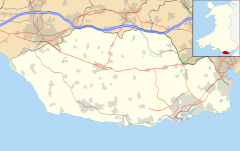 St. Nicholas Location within the Vale of Glamorgan | |
| Area | 0.2450 km2 (0.0946 sq mi) |
| Population | 654 (2021 Census)[1] |
| • Density | 2,669/km2 (6,910/sq mi) |
| Principal area | |
| Preserved county | |
| Country | Wales |
| Sovereign state | United Kingdom |
| Post town | CARDIFF |
| Postcode district | CF5 |
| Dialling code | 01446 |
| Police | South Wales |
| Fire | South Wales |
| Ambulance | Welsh |
| UK Parliament | |
St. Nicholas (Welsh: Sain Nicolas) is a small village in the Vale of Glamorgan, South Wales. It lies 2 miles west of the capital city, Cardiff and 7 miles from its city centre. St. Nicholas is the highest elevation village in the Vale of Glamorgan. The population was 417 in 2011.[2] It is in the community of St Nicholas and Bonvilston.
YouTube Encyclopedic
-
1/5Views:9 6034761 3431 238385
-
The Vale of Glamorgan
-
The Vale of Glamorgan promotional video
-
Tinkinswood And St Lythans - Back In Time To Mysterious Neolithic Wales
-
VALE OF GLAMORGAN RECYCLING P1
-
Glyndwr Vineyard, , Llanblethian Cowbridge, The Vale of Glamorgan
Transcription
Amenities & History
The A48 road divides the village in half, with a parish church and primary school north of it and housing south of it. However there are no shops or pubs in the village, the nearest being in Bonvilston or Culverhouse Cross. The A4226 (Five Mile Lane) connects it to nearby Barry from the A48.
The village lacks a pub and in 2017 the Church Hall was sold.
On October 6, 2016, a controversial planning application by Redrow Homes was granted, adding 100 dwellings to the village. A further 17 were added by Waterstone Homes. Building began in the summer of 2017, and on completion doubled the size of the village.
It is served by public transport by the First Cymru X2 service westbound to Bonvilston, Cowbridge, Bridgend and Porthcawl, and eastbound to Culverhouse Cross, Ely, Canton and Cardiff Central bus station.
Gallery
-

Presbyterian church
-

The former pub, The Three Tuns
-

Primary school
-

St. Nicholas War Memorial
-

The former church hall - now Church Hall House and Tinkenswood Hall
-

The Cory family tomb in St. Nicholas churchyard
-

Smith's Row of thatched cottages
References
- ^ "St Nicholas (The Vale of Glamorgan, Wales / Cymru, United Kingdom) - Population Statistics, Charts, Map, Location, Weather and Web Information". www.citypopulation.de. Retrieved 29 December 2022.
- ^ "Custom report - Nomis - Official Labour Market Statistics".
External links and Extra Information
Further information:
- St. Nicholas Village Website
- St Nicholas Church in Wales Primary School
- Photos of St. Nicholas and surrounding area on geograph.org.uk

| Authority control databases: National |
|---|
This Vale of Glamorgan location article is a stub. You can help Wikipedia by expanding it. |