
Solotvyno
Солотвино Slatina (in Romanian) Aknaszlatina (in Hungarian) | |
|---|---|
Urban-type settlement | |
 Solotvyno Settlement council building | |
 Coat of arms | |
 Solotvyno  Solotvyno | |
| Coordinates: 47°57′20″N 23°52′16″E / 47.95556°N 23.87111°E | |
| Country | |
| Oblast | |
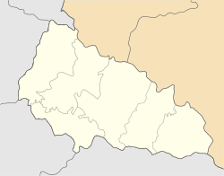
| Raion | Tiachiv Raion |
| Area | |
| • Total | 11.10 km2 (4.29 sq mi) |
| Elevation | 283 m (928 ft) |
| Population (2022) | |
| • Total | 8,391 |
| • Density | 760/km2 (2,000/sq mi) |
| Time zone | UTC+2 (EET) |
| • Summer (DST) | UTC+3 (EEST) |
| Postal codes | 90575—90578 |
| Area code | +380 3134 |
| KOATUU | 2124455900 |
 | |
Solotvyno (also Solotvina) (Ukrainian: Солотвино, Romanian: Slatina, Hungarian: Aknaszlatina and Hungarian: Faluszlatina, Rusyn: Солотвино, Yiddish: סעלאָטפֿינע (Selotfine), Slovak: Slatinské Doly) is an urban-type settlement in Tiachiv Raion in Zakarpattia Oblast of Ukraine, located adjacent to Romania, on the right bank of the Tisza River opposite the Romanian city of Sighetu Marmației. The village's name comes from the nearby salt mine.
YouTube Encyclopedic
-
1/5Views:3 7322 7625894 5791 403
-
Solotvyno - Ukraine 2017 4K UHD
-
solotvyno
-
Solotwyno Transcarpathia Ukraine, 4K DJI Mavic, GoPro
-
Солотвино(Slatina | Solotvyno)
-
solotvyno
Transcription
History
Solotvyno was first mentioned c. 1360 (the former one was burned down by the Tatars in 1241). In 1910, the town had a population of 2,330, the majority of whom were Hungarian. The current population is 8,391 (2022 estimate)[1]. In 1920, the town became part of the newly formed Czechoslovakia, in 1939 it returned to Hungary. Many of the large Jewish population died in the Holocaust. After World War II, Solotvino became part of Ukraine in the Soviet Union. According to the 2001 Ukrainian Census, the majority of the population in the city is Romanian. In 2001, 56.97% of the 8,956 inhabitants spoke Romanian as their native language, while 14.54% spoke Ukrainian, 24.3% Hungarian, and 3.18% Russian.[2]
The town is the final stop of the Ukrainian section of the railway, which runs from Lviv to Transcarpathia. The village has a museum of salt miners.
Notable residents
- Robert Maxwell, British MP, business owner and fraudster (1923–1991), born here when the village was part of the First Czechoslovak Republic.[3][4]
Gallery
-
 A salt mine in the town of Solotvyno
 -
 Recreation camp, "El dorado"
 -

-

-
 Underground office of the hospital
 -
 Former synagogue
 -
 Former synagogue, now bakery
 -
 Old Jewish cemetery
 -
 New Jewish cemetery
 -
 Jewish memorial plaque
References
- ^ Чисельність наявного населення України на 1 січня 2022 [Number of Present Population of Ukraine, as of January 1, 2022] (PDF) (in Ukrainian and English). Kyiv: State Statistics Service of Ukraine. Archived (PDF) from the original on 4 July 2022.
- ^ https://socialdata.org.ua/projects/mova-2001/
- ^ Марк Штейнберг. Евреи в войнах тысячелетий. p. 227. ISBN 5-93273-154-0 (in Russian)
- ^ Иван Мащенко (September 7–13, 2002). Медиа-олигарх из Солотвина. Зеркало недели (in Russian) (#34 (409)). Archived from the original on 2012-12-22.
External links
- Solotvyno Archived 2010-01-22 at the Wayback Machine
| Authority control databases: National |
|---|
This article about a location in Zakarpattia Oblast is a stub. You can help Wikipedia by expanding it. |