
Solgohachia /ˌsɑː.ɡəˈhæ.tʃi/ saw-gə-HA-chee[2] is an unincorporated community in Conway County, Arkansas, United States, about 10 miles (16 km) north of Morrilton on Arkansas Highway 9 and Arkansas Highway 287. The ZIP Code for Solgohachia is 72156.[3] The name is from the Choctaw word Sok-ko-huch-cha, meaning "muscadine river".[4]
Nearby Solgohachia Bridge was listed on the National Register of Historic Places on May 26, 2004. Unfortunately the old steel span bridge no longer exists.[citation needed] The creek it spanned is East Fork Point Remove Creek.[5]
YouTube Encyclopedic
-
1/1Views:422
-
How to Say or Pronounce USA Cities — Fouke, Arkansas
Transcription
Education
It is in the South Conway County School District.[6][7] It operates Morrilton High School.
References
- ^ a b U.S. Geological Survey Geographic Names Information System: Solgohachia, Arkansas
- ^ ""Mispronounced" town names".
- ^ "Solgohachia ZIP Code". zipdatamaps.com. 2022. Retrieved November 11, 2022.
- ^ Horatio Bardwell Cushman. (1899). History of the Choctaw, Chickasaw, and Natchez Indians. Greenville, Texas: Headlight Printing House.
- ^ "Archived copy". Archived from the original on October 13, 2006. Retrieved February 8, 2007.
{{cite web}}: CS1 maint: archived copy as title (link) - ^ "SCHOOL DISTRICT REFERENCE MAP (2010 CENSUS): Conway County, AR" (PDF). U.S. Census Bureau. Retrieved February 27, 2021.
- ^ "General Highway Map Conway County, Arkansas" (PDF). Arkansas Department of Transportation. Archived from the original (PDF) on July 18, 2011. Retrieved February 27, 2021. - See Solgohachia and Springfield on the map.
Municipalities and communities of Conway County, Arkansas, United States | ||
|---|---|---|
| Cities | 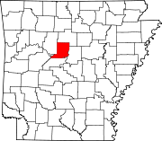 | |
| Town | ||
| CDPs | ||
| Other unincorporated communities | ||
This article about a location in Conway County, Arkansas is a stub. You can help Wikipedia by expanding it. |