
Sirmaur district | |
|---|---|
     Clockwise from top-left: Gurudwara Paonta Sahib, Rani Tal Shiva Temple, Nahan, Renuka Temple and Renuka Lake, Churdhar Sanctuary, Mangarh Shiva Temple | |
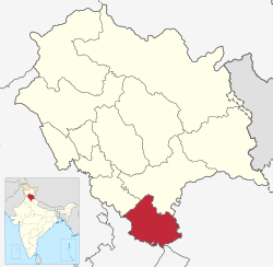 Location in Himachal Pradesh | |
| Coordinates (Nahan): 30°38′N 77°26′E / 30.64°N 77.44°E | |
| Country | |
| State | Himachal Pradesh |
| Headquarters | Nahan |
| Tehsils | 7 |
| Government | |
| • Vidhan Sabha constituencies | 5 |
| Area | |
| • Total | 2,825 km2 (1,091 sq mi) |
| Population (2011) | |
| • Total | 529,855 |
| • Density | 190/km2 (490/sq mi) |
| Demographics | |
| • Literacy | 79.98% |
| • Sex ratio | 915 |
| Time zone | UTC+05:30 (IST) |
| Vehicle registration | HP-16, HP-16AA, HP-17, HP-18, HP-71, HP-79, HP-85 |
| Website | http://hpsirmaur.nic.in/ |
Sirmaur district is the southernmost district of Himachal Pradesh, northern India. It is largely mountainous and rural, with 90% of its population living in villages. Some of its towns include the capital Nahan, Paonta Sahib, LANA PALAR, Tuheri, Bhawan, Shamra, UchaTikker and Suketi, the latter known for Shivalik Fossil Park.
YouTube Encyclopedic
-
1/5Views:19 06925 1703 46721 2341 562
-
सिरमौर जिला (हिमाचल प्रदेश) : Sirmaur district history || About a sirmaur zila || Himachal pradesh |
-
History of Sirmaur District
-
Sirmaur District
-
Himachal Gk for HAS 2021 | History of Sirmour | Sirmaur District | - HP GK For HAS and Allied Exams
-
Massive landslide occurred at Sirmaur district in Himachal Pradesh.
Transcription
Geography
There are seven tehsils in this district: Nahan, Renuka, Kamrau, Shillai, Rajgarh, Pachhad, and Paonta Sahib. The Giri River divides the district into two almost equal parts: Giripar and Giriaar. The major towns are Nahan, Paonta Sahib, Rajgarh, and Shillai.[citation needed]
History
| Year | Pop. | ±% p.a. |
|---|---|---|
| 1901 | 135,667 | — |
| 1911 | 138,500 | +0.21% |
| 1921 | 140,428 | +0.14% |
| 1931 | 148,547 | +0.56% |
| 1941 | 156,003 | +0.49% |
| 1951 | 166,053 | +0.63% |
| 1961 | 197,488 | +1.75% |
| 1971 | 244,922 | +2.18% |
| 1981 | 306,897 | +2.28% |
| 1991 | 379,695 | +2.15% |
| 2001 | 458,593 | +1.91% |
| 2011 | 529,855 | +1.45% |
| source:[1] | ||
Demographics
According to the 2011 Census of India, Sirmaur district has a population of 529,855, which placed it 542nd in India (out of a total of 640).[2] The district had a population density of 188 inhabitants per square kilometre (490/sq mi).[2] Its population growth rate over the decade 2001–2011 was 15.61%.[2] Sirmaur had a sex ratio of 915 females for every 1000 males,[2] and a literacy rate of 79.98%. 10.79% of the population lived in urban areas. Scheduled Castes and Scheduled Tribes made up 30.34% and 2.13% of the population respectively.[2]
As of the 2011 census, 39% of the population of the district identified their first language as Hindi, 34% as Pahari, and 20% as Sirmauri. There were also speakers of Punjabi (3.88%), Nepali (0.94%), Haryanvi, (0.43%), and Tibetan (0.42%).[4]
Simbalbara National Park
Declared a national park in 2010, Simbalbara National Park is located in Sirmaur district. It covers an area of around 27.88 sq.km. The fauna of Simbalbara National Park includes, Goral, Spotted Deer, Sambhar, Himalayan Black Bear, Hanuman Langurs and Indian Muntjacs. The flora includes Sal forests and lush green pastures.
Politics
| No. | Constituency | Member | Party | Remarks | Reference | |
|---|---|---|---|---|---|---|
| 55 | Pachhad (SC) | Suresh Kumar Kashyap | Bhartiya Janata Party | Member until May 2019 | ||
| Reena Kashyap | ||||||
| 56 | Nahan | Dr. Rajeev Bindal | Bhartiya Janata Party | |||
| 57 | Sri Renukaji (SC) | Vinay Kumar | Indian National Congress | |||
| 58 | Paonta Sahib | Sukh Ram Chaudhary | Bhartiya Janata Party | MPP and Power Minister | ||
| 59 | Shillai | Harshwardhan Chauhan | Indian National Congress | |||
See also
Notable people
References
- ^ Decadal Variation In Population Since 1901
- ^ a b c d e "District Census Handbook: Sirmaur" (PDF). censusindia.gov.in. Registrar General and Census Commissioner of India. 2011.
- ^ "Table C-01 Population by Religion: Himachal Pradesh". censusindia.gov.in. Registrar General and Census Commissioner of India. 2011.
- ^ "Table C-16 Population by Mother Tongue: Himachal Pradesh". www.censusindia.gov.in. Registrar General and Census Commissioner of India.
External links
- Official website
- Sirmour at a glance
- History of Sirmour
- Information about Sirmour District and its various places
Places adjacent to Sirmaur district | |
|---|---|

| International | |
|---|---|
| National | |
| Other | |