

Siirt District (also: Merkez, meaning "central" in Turkish) is a district of Siirt Province in Turkey. The municipality of Siirt is its seat.[1] The district had a population of 172,824 in 2021.[2] Its area is 633 km2.[3]
Geology and geomorphology
There is a national park called Botan valley national park in Siirt province.
Settlements
The district encompasses the municipality of Siirt, the belde of Gökçebağ (Ciwanika), thirty-five villages and thirty-seven hamlets.[1]
Villages
- Akdoğmuş (Gundişeyx)
- Aktaş (Berhurek)
- Akyamaç
- Bağlıca (Giravşe)
- Bayraktepe (Çul)
- Beşyol (Şamaşa)
- Bostancık (Dergalip)
- Çağbaşı (Tirim)
- Demirkaya (Hadid)
- Doluharman
- Eğlence (Çemê Pirê)
- Ekmekçiler (Binerver)
- İnkapı (Degele)
- Kalender
- Kavaközü (Tanze)
- Kayaboğaz (Xêrtê)
- Kemerli (Kevîk)
- Kışlacık (Lif)
- Koçlu (Gundişeyx)
- Konacık (Gundişeyx)
- Köprübaşı (Malikoz)
- Meşelidere (Gawat)
- Meydandere (Nepile)
- Ormanardı (Girdara)
- Pınarca (Kezer)
- Pınarova (Eyn Melek)
- Sağırsu (Hilela)
- Sağlarca (Bilorus)
- Sarıtepe (Şarno)
- Tuzkuyusu (Erbîne)
- Yağmurtepe (Xuşena)
- Yazlıca (Seyfiyê)
- Yerlibahçe (Kutmis)
- Yokuşbağları (Suske)
- Zorkaya
References
- ^ a b "Türkiye Mülki İdare Bölümleri Envanteri". T.C. İçişleri Bakanlığı (in Turkish). Retrieved 19 December 2022.
- ^ "31 ARALIK 2021 TARİHLİ ADRESE DAYALI NÜFUS KAYIT SİSTEMİ (ADNKS) SONUÇLARI" (XLS). TÜİK (in Turkish). Retrieved 16 December 2022.
- ^ "İl ve İlçe Yüz ölçümleri". General Directorate of Mapping. Retrieved 1 March 2023.
Siirt District in Siirt Province of Turkey | |||||||||||||||||||||||||||
|---|---|---|---|---|---|---|---|---|---|---|---|---|---|---|---|---|---|---|---|---|---|---|---|---|---|---|---|
| Districts |  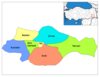 | ||||||||||||||||||||||||||
|
Metropolitan municipalities are bolded. | |||||||||||||||||||||||||||