
Shrigonda Taluka | |
|---|---|
 Location of Shrigonda Taluka in Ahmednagar district in Maharashtra | |
| Country | |
| State | Maharashtra |
| District | Ahmednagar |
| Headquarters | Shrigonda |
| Major villages | Kolgaon, Kashti,shedgaon Belavandi, Mandavgan Pargaon |
| Government | |
| • Lok Sabha constituency | Ahmednagar (Lok Sabha constituency) |
| • Assembly constituency | Shrigonda |
| • MLA | Babanrao Pachpute |
| Area | |
| • Total | 1,605.61 km2 (619.93 sq mi) |
| Population (2011) | |
| • Total | 315,975 |
| • Density | 200/km2 (510/sq mi) |
| Rain | 448.6 mm |
Shrigonda Taluka, is a taluka in Karjat subdivision of Ahmednagar District in Maharashtra state of India.[1] Its administrative headquarters is the town of Shrigonda.[2]
Area
The table below shows area of the taluka by land type.[3]
| Type of Land | Area (km2) | % of Total Area |
|---|---|---|
| Agriculture | 1385.16 | 86.27 |
| Forest | 152.1 | 9.47 |
| Other | 68.35 | 4.26 |
| Total | 1605.61 | 100 |
Villages
There are around 115 villages in Shrigonda taluka.
Population
Shrigonda taluka has a population of 315,975 according to the 2011 census. Shrigonda had a literacy rate of 76.25% and a sex ratio of 923 females per 1000 males. 31,134 (9.85%) live in urban areas. Scheduled Castes and Scheduled Tribes make up 12.72% and 4.39% of the population respectively.[5]
At the time of the 2011 Census of India, 93.83% of the population in the district spoke Marathi and 3.10% Hindi as their first language.[6]
Rain Fall
The Table below details of rainfall from year 1981 to 2004.[7]
| Year | Rainfall (mm) |
|---|---|
| 1981 | 614 |
| 1982 | 438 |
| 1983 | 521.6 |
| 1984 | 496 |
| 1985 | 359 |
| 1986 | 460 |
| 1987 | 497 |
| 1988 | 531 |
| 1989 | 610 |
| 1990 | 614 |
| 1991 | 438 |
| 1992 | 521.6 |
| 1993 | 496 |
| 1994 | 359 |
| 1995 | 460 |
| 1996 | 497 |
| 1997 | 531 |
| 1998 | 610 |
| 1999 | 571 |
| 2000 | 392 |
| 2001 | 352 |
| 2002 | 334 |
| 2003 | 87 |
| 2004 | 527 |
| 2005 | 484 |
| 2006 | 505 |
| 2007 | 675 |
| 2008 | 448 |
| 2009 | 499 |
| 2010 | 710 |
| 2011 | 326 |
See also
References
- ^ Talukas in Ahmednagar district. Ahmednagar.gov.in. Retrieved on 2011-12-23.
- ^ "Shrigonda". Ahmadnagar District. Archived from the original on 25 September 2012.
- ^ Talukas geographic information. Ahmednagar.gov.in. Retrieved on 2011-12-23.
- ^ "Table C-01 Population by Religion: Maharashtra". censusindia.gov.in. Registrar General and Census Commissioner of India. 2011.
- ^ "District Census Hand Book – Ahmednagar" (PDF). Census of India. Registrar General and Census Commissioner of India.
- ^ a b "Table C-16 Population by Mother Tongue: Maharashtra". censusindia.gov.in. Registrar General and Census Commissioner of India.
- ^ Rainfall information of Ahemadnagar district. Ahmednagar.gov.in. Retrieved on 2011-12-23.
Ahmednagar district topics | ||
|---|---|---|
| History | 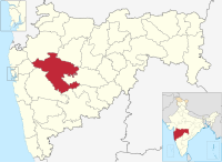 | |
| Geography | ||
| Talukas | ||
| Cities and towns | ||
| Monuments | ||
| Education | ||
| Lok Sabha constituencies | ||
| Vidhan Sabha constituencies | ||
| Dams in District | ||