


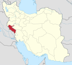
Shabab Rural District (Persian: دهستان شباب) is in Shabab District of Chardavol County, Ilam province, Iran.[3] Its capital is the village of Sang-e Sefid.
At the National Census of 2006, its population (as a part of the Central District) was 11,004 in 2,306 households.[4] There were 11,011 inhabitants in 2,796 households at the following census of 2011.[5] At the most recent census of 2016, the population of the rural district was 3,063 in 852 households, by which time it had been separated from the district in the establishment of Shahab District. The most populous of its 20 villages was Halehsam, with 494 people.[2]
YouTube Encyclopedic
-
1/3Views:49 4291 099856
-
Nancy Ajram - ولا يا ولا... أرحمني يا ولا
-
VOA news for Monday, April 6th, 2015
-
After Dark: Nocturnal Landscapes and Public Spaces in the Arabian Peninsula, Panel I
Transcription
References
- ^ OpenStreetMap contributors (28 March 2024). "Shabab Rural District (Chardavol County)" (Map). OpenStreetMap. Retrieved 28 March 2024.
- ^ a b "Census of the Islamic Republic of Iran, 1395 (2016)". AMAR (in Persian). The Statistical Center of Iran. p. 16. Archived from the original (Excel) on 1 November 2020. Retrieved 19 December 2022.
- ^ Rahimi, Mohammad Reza (7 July 2013). "With some changes in the geography map of Alborz and Ilam provinces: The counties of Fardis and Badreh and the city of Balavah were added to the map of the country's divisions". DOLAT (in Persian). Ministry of Interior, Board of Ministers. Archived from the original on 10 January 2017. Retrieved 11 November 2023.
- ^ "Census of the Islamic Republic of Iran, 1385 (2006)". AMAR (in Persian). The Statistical Center of Iran. p. 16. Archived from the original (Excel) on 20 September 2011. Retrieved 25 September 2022.
- ^ "Census of the Islamic Republic of Iran, 1390 (2011)". Syracuse University (in Persian). The Statistical Center of Iran. p. 16. Archived from the original (Excel) on 17 January 2023. Retrieved 19 December 2022.
Ilam province, Iran | ||||||||||||||||||||||||
|---|---|---|---|---|---|---|---|---|---|---|---|---|---|---|---|---|---|---|---|---|---|---|---|---|
Capital: Ilam | ||||||||||||||||||||||||
| Counties and cities |
|  | ||||||||||||||||||||||
| Sights |
| |||||||||||||||||||||||
| Populated places | ||||||||||||||||||||||||
This Chardavol County location article is a stub. You can help Wikipedia by expanding it. |