
Sanni Triveni
सान्नी त्रिवेणी गाउँपालिका | |
|---|---|
 Sanni Triveni Location in Nepal | |
| Coordinates: 29°17′39.1″N 81°35′30.8″E / 29.294194°N 81.591889°E | |
| Country | |
| Province | Karnali Province |
| District | Kalikot |
| Wards | 9 |
| Established | 10 March 2017 |
| Government | |
| • Type | Rural Council |
| • Chairperson | Mr. Dambar Bahadur Shahi (NCP) |
| • Vice-chairperson | Mrs. Hoija Kumari Budha (Giri) (NCP) |
| Area | |
| • Total | 136.71 km2 (52.78 sq mi) |
| Population (2011) | |
| • Total | 12,846 |
| • Density | 94/km2 (240/sq mi) |
| Time zone | UTC+5:45 (NST) |
| Headquarter | Mehalmudi |
| Website | sannitrivenimun |
Sanni Triveni (Nepali: सान्नी त्रिवेणी गाउँपालिका) is a rural municipality located in Kalikot District of Karnali Province of Nepal.[1][2]
According to Ministry of Federal Affairs and General Administration, Sanni Triveni rural municipality has an area of 136.71 square kilometres (52.78 sq mi) and the total population of the rural municipality is 12,846 as of 2011 Nepal census.
Mumra, Mehalmudi and Ranku which previously were all separate Village development committees merged to form this new local level body. Fulfilling the requirement of the new Constitution of Nepal 2015, Ministry of Federal Affairs and General Administration replaced all old VDCs and Municipalities into 753 new local level bodies.
The rural municipality is divided into total 9 wards and the headquarters of this newly formed rural municipality is situated at Mehalmudi.
References
- ^ "स्थानीय तहहरुको विवरण (Details of local levels)". www.mofald.gov.np/en. Ministry of Federal Affairs and General Administration. Retrieved 30 July 2018.
- ^ "Final District 1-75 Corrected Last for RAJPATRA" (PDF). Retrieved 30 July 2018.
External links
Headquarters: Manma (today part of Khandachakra Municipality) | ||
| Municipalities | 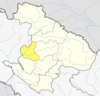 | |
| Rural municipalities | ||
| Former VDCs | ||
List of municipalities and rural municipalities of Nepal | ||
This article about a location in the Kalikot District of Nepal is a stub. You can help Wikipedia by expanding it. |