
Sakuho
佐久穂町 | |
|---|---|
 Sakuho Town Hall | |
 Flag  Seal | |
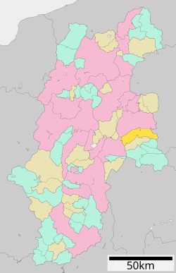 Location of Sakuho in Nagano Prefecture | |
 Sakuho | |
| Coordinates: 36°9′39.5″N 138°29′0.1″E / 36.160972°N 138.483361°E | |
| Country | Japan |
| Region | Chūbu (Kōshin'etsu) |
| Prefecture | Nagano |
| District | Minamisaku |
| Area | |
| • Total | 188.15 km2 (72.65 sq mi) |
| Population (April 2019) | |
| • Total | 11,076 |
| • Density | 59/km2 (150/sq mi) |
| Time zone | UTC+9 (Japan Standard Time) |
| Symbols | |
| Phone number | 0267-86-2525 |
| Address | 569 Takano-machi, Sakuho-machi, Minamisaku-gun, Nagano-ken 384-0697 |
| Website | http://www.town.sakuho.nagano.jp/ |

Sakuho (佐久穂町, Sakuho-machi) is a town located in Nagano Prefecture, Japan. As of 1 April 2019[update], the town had an estimated population of 11,076 in 4330 households,[1] and a population density of 59 persons per km2. The total area of the town is 188.15 square kilometres (72.65 sq mi).
YouTube Encyclopedic
-
1/1Views:1 596
-
LIFE IN THE FOREST // JAPAN
Transcription
Geography

Located in eastern Nagano prefecture, Sakuho stretches from west to east. It is situated in the Saku Basin, between the high peaks Mount Arafune and Mount Tateshina. The Shinano River flows through, and the mountainous parts of the town are located in the Yatsugatake-Chushin Kogen Quasi-National Park and the Myogi-Arafune-Saku Kogen Quasi-National Park.
- Mountains: Mount Morai
- Rivers: Chikuma River, Ōishi River, Nukui River
- Lakes: Futago Pond, Shirakoma Pond
Surrounding municipalities
Climate
The town has a climate characterized by hot and humid summers, and cold winters (Köppen climate classification Cfa). The average annual temperature in Sakuho is 10.4 °C. The average annual rainfall is 1661 mm with September as the wettest month. The temperatures are highest on average in August, at around 23.4 °C, and lowest in January, at around -0.2 °C.[2]
Demographics
Per Japanese census data,[3] the population of Sakuho has declined gradually over the past 50 years.
| Year | Pop. | ±% |
|---|---|---|
| 1960 | 17,267 | — |
| 1970 | 14,969 | −13.3% |
| 1980 | 14,228 | −5.0% |
| 1990 | 13,842 | −2.7% |
| 2000 | 13,622 | −1.6% |
| 2010 | 12,070 | −11.4% |
| 2020 | 10,218 | −15.3% |
History
The area of present-day Sakuho was part of ancient Shinano Province. The villages of Kaisei and Sakai were created with the establishment of the modern municipalities system on April 1, 1889, merging to form the town of Sakuho on February 1, 1955. Sakuho was created by the merger of Saku and the village of Yachiho on March 20, 2005.
Education
Sakuho has one public elementary school and one public middle school operated by the city government. The town does not have a high school.
Transportation
Railway
Highway
Local attractions
- Togyū Okumura Memorial Museum
References
External links
 Media related to Sakuho, Nagano at Wikimedia Commons
- Official Website (in Japanese)
| Core cities | |
|---|---|
| Cities | |
| Districts | |
| Former Districts | |
This Nagano Prefecture location article is a stub. You can help Wikipedia by expanding it. |