
Minamiminowa
南箕輪村 | |
|---|---|
 Minamiminowa Village Hall | |
 Flag  Seal | |
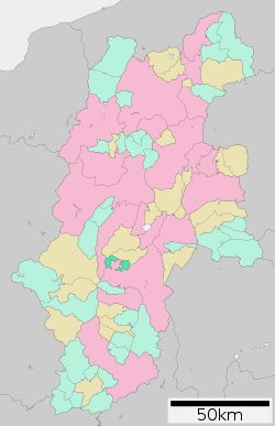 Location of Minamiminowa in Nagano Prefecture | |
 Minamiminowa | |
| Coordinates: 35°52′22.3″N 137°58′30.4″E / 35.872861°N 137.975111°E | |
| Country | Japan |
| Region | Chūbu (Kōshin'etsu) |
| Prefecture | Nagano |
| District | Kamiina |
| Area | |
| • Total | 40.99 km2 (15.83 sq mi) |
| Population (April 2019) | |
| • Total | 15,463 |
| • Density | 380/km2 (980/sq mi) |
| Time zone | UTC+9 (Japan Standard Time) |
| Symbols | |
| • Tree | Pinus densiflora |
| • Flower | Chrysanthemum |
| Phone number | 0265-72-2104 |
| Address | 4825-1 Minamiminowamura, Kamiina-gun, Nagano-ken 399-4592 |
| Website | Official website |

Minamiminowa (南箕輪村, Minamiminowa-mura) is a village located in Nagano Prefecture, Japan. As of 1 April 2019[update], the village had an estimated population of 15,463 in 6115 households,[1] and a population density of 371 persons per km². The total area of the village is 40.99 square kilometres (15.83 sq mi).
YouTube Encyclopedic
-
1/2Views:132 8663 827
-
南箕輪村パラパラ動画2022バージョン
-
Matsumoto Castle Virtually - Nagano Prefecture Japan
Transcription
Geography
Minamiminowa is located in the Ina Valley of south-central Nagano Prefecture, bordered by the Kiso Mountains to the west. The Tenryū River flows through the village. The village consists of two separate geographic areas, separated from each other by Ina City.
Surrounding municipalities
Climate
The town has a climate characterized by characterized by hot and humid summers, and cold winters (Köppen climate classification Cfa). The average annual temperature in Minamiminowa is 11.5 °C. The average annual rainfall is 1370 mm with September as the wettest month. The temperatures are highest on average in August, at around 24.4 °C, and lowest in January, at around -0.8 °C.[2]
Demographics
Per Japanese census data,[3] the population of Minamiminowa has seen strong growth over the past 60 years.
| Year | Pop. | ±% |
|---|---|---|
| 1940 | 4,466 | — |
| 1950 | 6,360 | +42.4% |
| 1960 | 6,043 | −5.0% |
| 1970 | 6,660 | +10.2% |
| 1980 | 8,877 | +33.3% |
| 1990 | 10,666 | +20.2% |
| 2000 | 13,404 | +25.7% |
| 2010 | 14,543 | +8.5% |
| 2020 | 15,797 | +8.6% |
History
The area of present-day Minaminowa was part of ancient Shinano Province. The village of Minamiminowa was established on April 1, 1889 by the establishment of the modern municipalities system.
Economy
The economy of Minaminowa is based on agriculture, with rice, apples, blueberries and wasabi among the major crops.
Education
Minamiminowa has two public elementary schools and one public middle school operated by the village government, and one high school operated the Nagano Prefectural Board of Education. The village is also host to the Agricultural Department of Shinshu University
Transportation
Railway
Highway
References
External links
 Media related to Minamiminowa, Nagano at Wikimedia Commons
- Official Website (in Japanese)
| International | |
|---|---|
| National | |
| Core cities | |
|---|---|
| Cities | |
| Districts | |
| Former Districts | |
This Nagano Prefecture location article is a stub. You can help Wikipedia by expanding it. |