
Saint-Damase | |
|---|---|
 | |
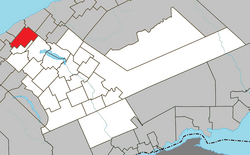 Location within La Matapédia RCM. | |
 Saint-Damase Location in eastern Quebec. | |
| Coordinates: 48°40′N 67°50′W / 48.667°N 67.833°W[1] | |
| Country | |
| Province | |
| Region | Bas-Saint-Laurent |
| RCM | La Matapédia |
| Settled | 1868 |
| Constituted | December 31, 1885 |
| Government | |
| • Mayor | Jean-Marc Dumont |
| • Federal riding | Haute-Gaspésie—La Mitis—Matane—Matapédia |
| • Prov. riding | Matane-Matapédia |
| Area | |
| • Total | 118.20 km2 (45.64 sq mi) |
| • Land | 116.42 km2 (44.95 sq mi) |
| Population | |
| • Total | 382 |
| • Density | 3.3/km2 (9/sq mi) |
| • Pop 2016-2021 | |
| • Dwellings | 178 |
| Time zone | UTC−5 (EST) |
| • Summer (DST) | UTC−4 (EDT) |
| Postal code(s) | |
| Area code(s) | 418 and 581 |
| Highways | |
| Website | saint-damase |
Saint-Damase is a parish municipality in Quebec, Canada.
Demographics
| Year | Pop. | ±% |
|---|---|---|
| 1891 | 863 | — |
| 1901 | 896 | +3.8% |
| 1911 | 1,019 | +13.7% |
| 1921 | 1,190 | +16.8% |
| 1931 | 1,124 | −5.5% |
| 1941 | 1,215 | +8.1% |
| 1951 | 1,127 | −7.2% |
| 1956 | 991 | −12.1% |
| 1961 | 894 | −9.8% |
| 1966 | 766 | −14.3% |
| 1971 | 624 | −18.5% |
| 1976 | 525 | −15.9% |
| 1981 | 489 | −6.9% |
| 1986 | 445 | −9.0% |
| 1991 | 435 | −2.2% |
| 1996 | 439 | +0.9% |
| 2001 | 449 | +2.3% |
| 2006 | 446 | −0.7% |
| 2011 | 397 | −11.0% |
| 2016 | 356 | −10.3% |
| 2021 | 382 | +7.3% |
In the 2021 Census of Population conducted by Statistics Canada, Saint-Damase had a population of 382 living in 165 of its 178 total private dwellings, a change of 7.3% from its 2016 population of 356. With a land area of 116.42 km2 (44.95 sq mi), it had a population density of 3.3/km2 (8.5/sq mi) in 2021.[6]
Canada census – Saint-Damase community profile
| 2021 | 2016 | 2011 | |
|---|---|---|---|
| Population | 382 (+7.3% from 2016) | 426 (+7.3% from 2011) | 397 (-11.0% from 2006) |
| Land area | 116.42 km2 (44.95 sq mi) | 116.69 km2 (45.05 sq mi) | 117.02 km2 (45.18 sq mi) |
| Population density | 3.3/km2 (8.5/sq mi) | 3.7/km2 (9.6/sq mi) | 3.4/km2 (8.8/sq mi) |
| Median age | 46.4 (M: 49.6, F: 42.8) | 49.8 (M: 52.1, F: 47.3) | 45.9 (M: 47.2, F: 45.5) |
| Private dwellings | 178 (total) | 210 (total) | 177 (total) |
| Median household income | $55,600 | $56,960 | $40,898 |
Mother tongue:[12]
- English as first language: 0%
- French as first language: 98.7%
- English and French as first language: 0%
- Other as first language: 0%

See also
References
- ^ "Reference number 55877 in Banque de noms de lieux du Québec". toponymie.gouv.qc.ca (in French). Commission de toponymie du Québec.
- ^ a b "Saint-Damase". Répertoire des municipalités (in French). Ministère des Affaires municipales, des Régions et de l'Occupation du territoire. Retrieved 2012-01-26.
- ^ "Census Profile, 2021 Census - Saint-Damase, Census subdivision, Quebec". 26 October 2022.
- ^ "Census Profile, 2021 Census - Saint-Damase, Census subdivision, Quebec". 26 October 2022.
- ^ Statistics Canada: 1996, 2001, 2006, 2011, 2016, 2021 census
- ^ "Population and dwelling counts: Canada, provinces and territories, and census subdivisions (municipalities), Quebec". Statistics Canada. February 9, 2022. Retrieved August 29, 2022.
- ^ "2021 Community Profiles". 2021 Canadian Census. Statistics Canada. February 4, 2022. Retrieved 2022-11-15.
- ^ "2016 Community Profiles". 2016 Canadian Census. Statistics Canada. August 12, 2021. Retrieved 2022-07-13.
- ^ "2011 Community Profiles". 2011 Canadian Census. Statistics Canada. March 21, 2019. Retrieved 2014-02-08.
- ^ "2006 Community Profiles". 2006 Canadian Census. Statistics Canada. August 20, 2019.
- ^ "2001 Community Profiles". 2001 Canadian Census. Statistics Canada. July 18, 2021.
- ^ "Saint-Damase Census Profile, 2021 Census". 2021 Census data. Statistics Canada. Retrieved 2022-11-15.
Wikimedia Commons has media related to Saint-Damase, Bas-Saint-Laurent, Quebec.
Adjacent Municipal Subdivisions | ||||||||||||||||
|---|---|---|---|---|---|---|---|---|---|---|---|---|---|---|---|---|
| ||||||||||||||||
| Cities & Towns | |
|---|---|
| Municipalities | |
| Parishes | |
| Villages | |
| Unorganized territories | |
| |
| International | |
|---|---|
| National | |