

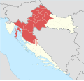
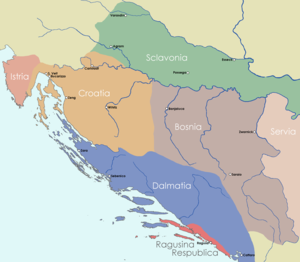
The Republic of Croatia is administratively organised into twenty counties, and is also traditionally divided into four historical and cultural regions: Croatia proper, Dalmatia, Istria, and Slavonia.[1] These are further divided into other, smaller regions.
YouTube Encyclopedic
-
1/5Views:45 3388 459254 4701 8187 652
-
A Super Quick History of Croatia
-
map of Croatia
-
Fun With Flags #26 - Croatia
-
Counties of Croatia vs Slovenian Regions, GDP per capita, 1990-2026
-
Kingdom of Croatia
Transcription
Historical regions
| Coat of arms | Name | Location | Description |
|---|---|---|---|
|
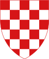
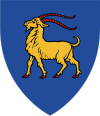
Croatia proper |
|
The central part of the Republic of Croatia that also holds the capital Zagreb. |

|
Dalmatia | 
|
Dalmatia consists of much of the coastline of the Republic of Croatia, and stretches from the island of Rab in the north of the country to the Bay of Kotor in the south. Dubrovnik, one of Croatia's most important tourist cities, is in Dalmatia. The largest city is Split. |
|
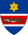
Slavonia | 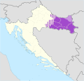
|
This region comprises the majority of inland eastern Croatia, and was also once its own kingdom. |
|
Istria | 
|
Istria consists mainly of the Croatian part of the peninsula of Istria. Pula is the largest city in Croatian Istria, and sits at the peninsula's southern tip. |
Smaller regions
is a region in central Croatia, situated between the rivers Sava, Una and Kupa.
forms a small enclave between the region of Slavonia and the Republic of Hungary, it lies in the north east of Croatia. The rest of the region known as Baranja is located in Hungary.
- Croatian Littoral (Hrvatsko primorje)
the maritime region of Croatia proper
the region occupies the area between the major cities of Karlovac and Rijeka (a.k.a. Fiume). The regions main city is Delnice. The river Kupa separates the region from the Republic of Slovenia in the north.
forms a small subregion of Dalmatia in the very south of Croatia and stretches from the town of Cavtat up to the Prevlaka peninsula near Montenegro border.
is a region in central Croatia, situated between Lika and Banovina.
lies at the cross-roads between continental and coastal Croatia. Apart from those that go through narrow region of Gorski Kotar to the north all Croatian roads that lead to the sea from Zagreb pass through Lika. One of Croatia's most famous national parks: the Plitvice Lakes National Park is located in this region.
is a small region in northern Croatia, situated between rivers Mura and Drava.
is a microregion located in the Croatian counties of: Zagreb County, Sisak-Moslavina County and Bjelovar-Bilogora County. Its main cities are Kutina and Ivanić-Grad.
is the Croatian region that lies around the river Drava along Croatia's northern border with Hungary.
this region lies along the Croato-Serbian border in eastern Slavonia. The border follows the flow of the river Danube (Dunav) giving the region its name.
the region is located around the river Sava that runs through central Croatia and then along the Croato-Bosnian border in southern Slavonia.
the region around Zagreb, roughly between Žumberak and Moslavina.
- Syrmia (or Srijem)
this region is divided between Serbia and Croatia. In Croatia it is in the very east of the country.
a microregion in the Sava river valley south of Zagreb, with city of Velika Gorica in its center.
- Hrvatsko Zagorje ("Croatian Upland", or simply Zagorje)
Hrvatsko Zagorje lies to the north of the Croatian capital city: Zagreb. Other major cities include the world-famous archeological site of Krapina and the baroque town of Varaždin. Its northern border is the Republic of Slovenia and the regions of Podravina and Međimurje, to the east lies Slavonia and to the west lies Kordun and Gorski Kotar.
- Dalmatinska Zagora ("Dalmatian Hinterland", or simply Zagora)
the hinterland region of Dalmatia.
References
- ^ Stallaerts, Robert (2009). Historical Dictionary of Croatia. Scarecrow Press. p. 4. ISBN 978-0810873636.
| Principal historical regions |  | ||||||||
|---|---|---|---|---|---|---|---|---|---|
| Smaller regions |
| ||||||||