
Rasulpur
Rasūlpur | |
|---|---|
Village | |
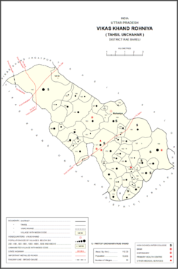 Map showing Rasulpur (#158) in Rohaniya CD block | |
 Rasulpur Location in Uttar Pradesh, India | |
| Coordinates: 25°56′07″N 81°25′55″E / 25.935399°N 81.431883°E[1] | |
| Country India | |
| State | Uttar Pradesh |
| District | Raebareli |
| Area | |
| • Total | 9.272 km2 (3.580 sq mi) |
| Population (2011)[2] | |
| • Total | 7,671 |
| • Density | 830/km2 (2,100/sq mi) |
| Languages | |
| • Official | Hindi |
| Time zone | UTC+5:30 (IST) |
| Vehicle registration | UP-35 |
Rasulpur is a village in Rohaniya block of Rae Bareli district, Uttar Pradesh, India.[2] One of the largest villages in the historical pargana of Salon,[3] it is located 48 km from Raebareli, the district headquarters.[4] As of 2011, it has a population of 7,671 people, in 1,379 households.[2] It has one primary school and no healthcare facilities.[2]
The 1961 census recorded Rasulpur as comprising 18 hamlets, with a total population of 3,089 people (1,498 male and 1,591 female), in 724 households and 707 physical houses.[5] The area of the village was given as 3,342 acres and it had electricity and a post office at that point.[5]
The 1981 census recorded Rasulpur (as "Rasoolpur") as having a population of 4,059 people, in 1,103 households, and having an area of 725.60 hectares.[4] The main staple foods were listed as wheat and rice.[4]
References
- ^ "GeoNames Search". geonames.nga.mil. Archived from the original on 12 April 2014. Retrieved 17 August 2023.
- ^ a b c d e "Census of India 2011: Uttar Pradesh District Census Handbook - Rae Bareli, Part A (Village and Town Directory)" (PDF). Census 2011 India. pp. 365–74. Retrieved 25 August 2021.
- ^ Nevill, H.R. (1905). Rai Bareli: A Gazetteer, Being Volume XXXIX Of The District Gazetteers Of The United Provinces Of Agra And Oudh. Allahabad: Government Press. p. 217. Retrieved 25 August 2021.
- ^ a b c Census 1981 Uttar Pradesh: District Census Handbook Part XIII-A: Village & Town Directory, District Rae Bareli (PDF). 1982. pp. 230–1. Retrieved 25 August 2021.
- ^ a b Census 1961: District Census Handbook, Uttar Pradesh (39 - Raebareli District) (PDF). Lucknow. 1965. pp. cxii-cxiii of section "Salon Tahsil". Retrieved 25 August 2021.
{{cite book}}: CS1 maint: location missing publisher (link)
This Raebareli district location article is a stub. You can help Wikipedia by expanding it. |