| Puruni River | |
|---|---|
| Location | |
| Country | Guyana |
| Physical characteristics | |
| Mouth | |
• coordinates | 6°00′N 59°12′W / 6.000°N 59.200°W |
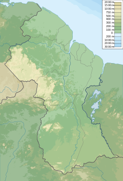
The Puruni River (Spanish: Rio Carmen) is a river of Guyana in the Cuyuni-Mazaruni region.
In 2017, Ministry of Natural Resources issued five cease and desist orders against gold-mining dredges on the Puruni river. Gold mining is done on many waterways in the country, and the dredging process has had a detrimental impact on bio-diversity.[1] The Guyana Human Rights Association, described the river as “a ruinous mess of tailings and devastation” for miles and unnavigable for large stretches.[2] The remote area has very little oversight, so crime is a major problem around the mining camps,[3] and many Brazilian miners also mine illegally.[4]
Logging also takes place in the area surrounding the river.[4]
See also
References
- ^ "Human rights group commends ministry for Puruni cease orders". Stabroek News. 2017-05-07. Retrieved 2021-01-13.
- ^ "A stark warning about the devastation the Bolsonaro government is likely to wreck upon the river basin". Human Rights Documents Online. Retrieved 2021-01-13.
- ^ "Miners want action against 'floating shops'". Stabroek News. 2011-10-12. Retrieved 2021-01-13.
- ^ a b "Toolsie Persaud Timber Traders applies for large-scale logging permit". Stabroek News. 2016-07-04. Retrieved 2021-01-13.
Bibliography
- Rand McNally, The New International Atlas, 1993.
6°00′N 59°12′W / 6.000°N 59.200°W

