| Demerara River | |
|---|---|
 Crossing the Demerara River via the Demerara Harbour Bridge | |
| Location | |
| Country | Guyana |
| Physical characteristics | |
| Mouth | Atlantic Ocean |
• location | Georgetown |
• coordinates | 6°48′44″N 58°10′12″W / 6.8121°N 58.1701°W |
| Length | 346 km (215 mi) |
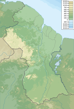
The Demerara River is a river in eastern Guyana that rises in the central rainforests of the country and flows to the north for 346 kilometres until it reaches the Atlantic Ocean. Georgetown, Guyana's largest seaport and capital, is situated on the east bank of the river's mouth. The river divides Essequibo Islands-West Demerara (Region 3) on the west bank from Demerara-Mahaica (Region 4) to the east.
The name "Demerara" comes from a variant of the Arawak word "Immenary" or "Dumaruni" which means "river of the letter wood" (wood of Brosimum guianense tree).[1]
YouTube Encyclopedic
-
1/3Views:12 30716 26580 706
-
Final feasibility study report on the new Demerara Harbor Bridge river crossing.
-
Guyana Demerara River: Massive Dark Cloud Potential Tropical Cyclone 5 FLOOD WATCH GUYANA
-
Demerara River Linden/ Fishing
Transcription
Features
Demerara's estuary is narrow and the flowrate is rapid. This scouring action maintains a 5-to-6-metre-deep direct channel to the ocean. The river's deep brown color is primarily the result of the massive quantities of silt carried from upriver by the powerful currents. So powerful are these currents, that the ocean retains the Demerara's brown color for a considerable distance out to sea.
Tributaries of the Demerara River include the Haiama River,[2] Kuruabaru River,[3] Haiakwa Creek[4] and Haianari Creek.
The islands Inver, Borsselen, and Biesen are found 25 to 30 kilometres (15 to 20 mi) from the mouth. Borsselen was once the location of the Dutch capital of Demerara.[5]
Transportation and use
The Demerara's width and depth allow oceangoing vessels up to 5,000 t to navigate up to Linden (105 km from the mouth), while smaller vessels may reach up to Malali (245 km from the mouth). Beyond Malali, numerous rapids make further upstream travel impossible.
A floating bridge, the Demerara Harbour Bridge, crosses the river 6 kilometres (4 mi) south of Georgetown from Peter's Hall, East Bank Demerara to Schoon Ord, West Bank Demerara.[6]
A Dutch colony of the same name was situated along the river's banks. The colony founded the sugarcane industry that continues to thrive today. Bauxite is also mined around the Demerara, and Linden is a major export centre.
References
- ^ Benn, Brindley H. (1962-06-30). "Guyana the Name". Thunder. Georgetown, Guyana. Archived from the original on May 1, 2008.
- ^ Guiana, British (1916). The Official Gazette of British Guiana. p. 1529.
- ^ "Indonesian national dies after hitting head on felled tree root". Stabroek News. 2019-04-07. Retrieved 2021-01-06.
- ^ Guiana, British (1905). Administration Reports, for the Year ... p. 264.
- ^ "Establishment of Demerara". Guyana Times International. Retrieved 30 August 2020.
- ^ The Demerara Harbour Bridge. Archived 2019-03-06 at the Wayback Machine overtown.org.uk Retrieved 4 March 2019.

