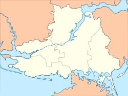
Prydniprovske
Придніпровське | |
|---|---|
| Coordinates: 46°40′48″N 32°47′31″E / 46.68000°N 32.79194°E | |
| Country | |
| Oblast | Kherson Oblast |
| Raion | Kherson Raion |
| Hromada | Kherson urban hromada |
| Area | |
| • Total | 0.086 km2 (0.033 sq mi) |
| Elevation | 25 m (82 ft) |
| Postal code | 75035 |
Prydniprovske (Ukrainian: Придніпровське) is a rural-type settlement in southern Ukraine, located in Kherson urban hromada, Kherson Raion, Kherson Oblast.[1]
History
On 12 June 2020, in accordance with a decree by the Ukrainian parliament determining the extents and administrative centers of hromadas in Kherson Oblast, Prydniprovske became part of Kherson urban hromada.[2] On 17 July 2020, as a result of nationwide administrative reforms, it, along with the rest of the hromada, became part of the newly formed Kherson Raion.[3]
In March 2022, the village was occupied by Russia during the Russian invasion of Ukraine.[4] It was liberated by Ukrainian forces in November 2022 during the 2022 Kherson counteroffensive.[5]
References
- ^ "Придніпровське - Херсонська область". decentralization.gov.ua. Retrieved 2023-10-19.
- ^ "Про визначення адміністративних центрів та затвердження територій територіальних громад Херсонської області". Офіційний вебпортал парламенту України (in Ukrainian). Retrieved 2022-10-07.
- ^ "Про утворення та ліквідацію районів". Офіційний вебпортал парламенту України (in Ukrainian). Retrieved 2023-10-19.
- ^ "Військовий експерт пояснив, чому російські війська так швидко захопили Херсонську область". www.unian.ua (in Ukrainian). Retrieved 2023-02-27.
- ^ "Russians attack Kherson Oblast 30 times in one day: one person killed, two injured". Ukrainska Pravda. Retrieved 2023-10-19.
46°40′45″N 32°47′32″E / 46.67917°N 32.79222°E


